இலங்கையின் மாவட்டங்கள்
| இலங்கையின் மாவட்டம் District | |
|---|---|
 | |
| வகை | இரண்டாம் நிலை நிருவாக அலகு |
| அமைவிடம் | இலங்கை |
| எண்ணிக்கை | 25 (as of பெப்ரவரி 1984) |
| மக்கள்தொகை | 92,238–2,324,349 |
| பரப்புகள் | 699–7,179 கிமீ² |
| அரசு | மாவட்டச் செயலாளர் |
| உட்பிரிவுகள் | பிரதேச செயலகம் |
இலங்கையின் மாவட்டங்கள் (disticts) என்பவை இரண்டாம்-தர நிருவாக அலகுகளாகும். இவை மாகாணங்களுக்கு உள்ளடக்கப்பட்டுள்ளன. இவை நிர்வாகம், தேர்தல் தொடர்பாக ஏற்படுத்தப்பட்ட அலகுகளாகும். இலங்கையின் 9 மாகாணங்களில் 25 மாவட்டங்கள் அமைக்கப்பட்டுள்ளன.[1] ஒவ்வொரு மாவட்டமும் நடுவண் அரசினால் நியமிக்கப்படும்[2] மாவட்டச் செயலாளர் என அழைக்கப்படும் இலங்கை நிர்வாகச் சேவை அதிகாரியின் கீழ் நிருவகிக்கப்படுகிறது.[3] நடுவண் அரசு மற்றும் பிரதேச செயலகங்கள் ஆகியவற்றுக்கிடையேயான தொடர்புகளை ஒருங்கிணைபதே மாவட்டச் செயலாளரின் முக்கிய பணியாகும். மாவட்ட ரீதியான அபிவிருத்தித் திட்டங்களை முன்னெடுப்பது, மாவட்டத்துக்குக் கீழுள்ள சிறிய நிருவாக அலகுக்கு உதவிகள் வழங்குவது போன்றவையும் மாவட்ட செயலாளரின் பணிகளாகும்.[4] அத்துடன் வருவாய் சேகரிப்பு, மாவட்டங்களில் தேர்தல்களை ஒழுங்குபடுத்துவது போன்ற பணிகளும் முக்கியமானவையாகும்.[5]
மாவட்டம் ஒவ்வொன்றும் பல பிரதேச செயலகங்களாகப் பிரிக்கப்பட்டுள்ளன. நாட்டில் மொத்தம் 256 பிரதேச செயலகங்கள் உள்ளன.[1] பிரதேச செயலகங்கள் மேலும் கிராம சேவகர் பிரிவுகளாகப் பிரிக்கப்பட்டுள்ளன.[6]
மாவட்டத் தரவுகள்[தொகு]
2012 கணக்கெடுப்பின் படி, மாவட்ட ரீதியாக மக்கள்தொகை தரவுகள்:
| மாவட்டம் | மாவட்ட நிலவரை |
மாகாணம் | மாவட்டத் தலைநகர் |
நிலப் பரப்பு கிமீ2 (மை2)[7] |
உள்ளூர் நீர்ப் பரப்பு கிமீ2 (மை2)[7] |
மொத்தப் பரப்பு கிமீ2 (மை2) |
மக்கள் தொகை (2012)[8] |
மக்கள் அடர்த்தி /கிமீ2 (/மைல்2)[a] |
|---|---|---|---|---|---|---|---|---|
| அம்பாறை | 
|
கிழக்கு | அம்பாறை | 4,222 (1,630) | 193 (75) | 4,415 (1,705) | 649,402 | 154 (400) |
| அனுராதபுரம் | 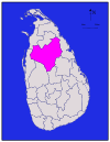
|
வடமத்திய | அனுராதபுரம் | 6,664 (2,573) | 515 (199) | 7,179 (2,772) | 860,575 | 129 (330) |
| பதுளை | 
|
ஊவா | பதுளை | 2,827 (1,092) | 34 (13) | 2,861 (1,105) | 815,405 | 288 (750) |
| மட்டக்களப்பு | 
|
கிழக்கு | மட்டக்களப்பு | 2,610 (1,010) | 244 (94) | 2,854 (1,102) | 526,567 | 202 (520) |
| கொழும்பு | 
|
மேற்கு | கொழும்பு | 676 (261) | 23 (8.9) | 699 (270) | 2,324,349 | 3,438 (8,900) |
| காலி | 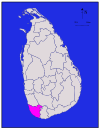
|
தெற்கு | காலி | 1,617 (624) | 35 (14) | 1,652 (638) | 1,063,334 | 658 (1,700) |
| கம்பகா | 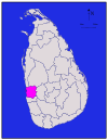
|
மேற்கு | கம்பகா | 1,341 (518) | 46 (18) | 1,387 (536) | 2,304,833 | 1,719 (4,450) |
| அம்பாந்தோட்டை | 
|
தெற்கு | அம்பாந்தோட்டை | 2,496 (964) | 113 (44) | 2,609 (1,007) | 599,903 | 240 (620) |
| யாழ்ப்பாணம் | 
|
வடக்கு | யாழ்ப்பாணம் | 929 (359) | 96 (37) | 1,025 (396) | 583,882 | 629 (1,630) |
| களுத்துறை | 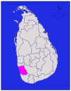
|
மேற்கு | களுத்துறை | 1,576 (608) | 22 (8.5) | 1,598 (617) | 1,221,948 | 775 (2,010) |
| கண்டி | 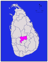
|
மத்திய | கண்டி | 1,917 (740) | 23 (8.9) | 1,940 (750) | 1,375,382 | 716 (1,850) |
| கேகாலை | 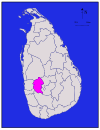
|
சபரகமுவா | கேகாலை | 1,685 (651) | 8 (3.1) | 1,693 (654) | 840,648 | 499 (1,290) |
| கிளிநொச்சி | 
|
வடக்கு | கிளிநொச்சி | 1,205 (465) | 74 (29) | 1,279 (494) | 113,510 | 94 (240) |
| குருணாகல் | 
|
வடமேற்கு | குருணாகல் | 4,624 (1,785) | 192 (74) | 4,816 (1,859) | 1,618,465 | 350 (910) |
| மன்னார் | 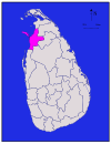
|
வடக்கு | மன்னார் | 1,880 (730) | 116 (45) | 1,996 (771) | 99,570 | 53 (140) |
| மாத்தளை | 
|
மத்திய | மாத்தளை | 1,952 (754) | 41 (16) | 1,993 (770) | 484,531 | 248 (640) |
| மாத்தறை | 
|
தெற்கு | மாத்தறை | 1,270 (490) | 13 (5.0) | 1,283 (495) | 814,048 | 641 (1,660) |
| மொனராகலை | 
|
ஊவா | மொனராகலை | 5,508 (2,127) | 131 (51) | 5,639 (2,177) | 451,058 | 82 (210) |
| முல்லைத்தீவு | 
|
வடக்கு | முல்லைத்தீவு | 2,415 (932) | 202 (78) | 2,617 (1,010) | 92,238 | 38 (98) |
| நுவரெலியா | 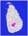
|
மத்திய | நுவரெலியா | 1,706 (659) | 35 (14) | 1,741 (672) | 711,644 | 417 (1,080) |
| பொலன்னறுவை | 
|
வடமத்தி | பொலன்னறுவை | 3,077 (1,188) | 216 (83) | 3,293 (1,271) | 406,088 | 132 (340) |
| புத்தளம் | 
|
வட மேல் | புத்தளம் | 2,882 (1,113) | 190 (73) | 3,072 (1,186) | 762,396 | 265 (690) |
| இரத்தினபுரி | 
|
சபரகமுவா | இரத்தினபுரி | 3,236 (1,249) | 39 (15) | 3,275 (1,264) | 1,088,007 | 336 (870) |
| திருகோணமலை | 
|
கிழக்கு | திருக்கோணமலை | 2,529 (976) | 198 (76) | 2,727 (1,053) | 379,541 | 150 (390) |
| வவுனியா | 
|
வடக்கு | வவுனியா | 1,861 (719) | 106 (41) | 1,967 (759) | 172,115 | 92 (240) |
| மொத்தம் | 62,705 (24,211) | 2,905 (1,122) | 65,610 (25,330) | 20,263,723 | 323 (840) |
மேலும் சில தகவல்கள்[தொகு]
இந்த பக்கம் காலாவதியாகிவிட்டது. தயவுகூர்ந்து இந்த பக்கம் தற்போதைய நடப்புகளுக்கு ஏற்ப புதிய தகவல்களைச் சேர்த்து கட்டுரையை புதுப்பிக்கவும். மேலும் தகவல்களுக்கு, தயவுசெய்து பேச்சுப் பக்கத்தைப் பார்க்கவும். |
| மாவட்டம் | பிரதேச செயலாளர் பிரிவு | பிரதேச சபைகள் | மாநகரங்கள் | நகரங்கள் | வட்டாரங்கள் | தேர்தல் தொகுதிகள் | ஊரூழியர் பிரிவுகள் | கிராமங்கள் | மக்கள்தொகை | 1981-2001 வளர்ச்சிவீதம் | மக்களடர்த்தி | பரப்பளவு | நீர் |
| கொழும்பு | 13 | 6 | 4 | 3 | 121 | 15 | 557 | 808 | 2234289 | 1.3 | 3305 | 699 | 23 |
| கம்பகா | 13 | 12 | 2 | 5 | 72 | 13 | 1177 | 1911 | 2066096 | 1.9 | 1541 | 1387 | 46 |
| களுத்துறை | 14 | 10 | 0 | 4 | 35 | 8 | 762 | 2652 | 1060800 | 1.2 | 673 | 1598 | 22 |
| கண்டி | 20 | 17 | 1 | 4 | 58 | 13 | 1188 | 2987 | 1272463 | 1 | 664 | 1940 | 23 |
| மாத்தளை | 11 | 11 | 1 | 0 | 13 | 4 | 545 | 1355 | 442427 | 1.1 | 227 | 1993 | 41 |
| நுவரெலியா | 5 | 5 | 1 | 2 | 24 | 4 | 491 | 1421 | 700083 | 0.7 | 410 | 1741 | 35 |
| காலி | 18 | 15 | 1 | 2 | 37 | 10 | 896 | 2311 | 990539 | 1 | 613 | 1652 | 35 |
| மாத்தறை | 16 | 12 | 1 | 1 | 21 | 7 | 650 | 1598 | 761236 | 0.8 | 599 | 1283 | 13 |
| அம்பாந்தோட்டை | 12 | 9 | 0 | 2 | 12 | 4 | 576 | 1319 | 525370 | 1.1 | 210 | 2609 | 113 |
| யாழ்ப்பாணம் | 14 | 12 | 1 | 3 | 52 | 10 | 435 | 954 | 490,621* | -2 | 528 | 1025 | 96 |
| வவுனியா | 4 | 4 | 0 | 1 | 11 | 1 | 102 | 527 | 149,835* | 2.2 | 81 | 1996 | 116 |
| முல்லைத்தீவு | 4 | 4 | 0 | 0 | 0 | 1 | 127 | 516 | 121,667* | 2.2 | 50 | 1967 | 106 |
| கிளிநொச்சி | 3 | 3 | 0 | 0 | 0 | 1 | 95 | 258 | 127,263* | 1.6 | 106 | 2617 | 202 |
| மட்டக்களப்பு | 12 | 10 | 1 | 1 | 19 | 3 | 345 | 857 | 486,447* | 1.9 | 186 | 2854 | 244 |
| அம்பாறை | 19 | 14 | 0 | 2 | 9 | 4 | 504 | 876 | 589344 | 2 | 140 | 4415 | 193 |
| திருகோணமலை | 10 | 10 | 0 | 1 | 12 | 3 | 230 | 645 | 340,158* | 1.4 | 135 | 2727 | 198 |
| குருநாகல் | 27 | 18 | 1 | 1 | 21 | 14 | 1610 | 4509 | 1452369 | 0.9 | 314 | 4816 | 192 |
| புத்தளம் | 16 | 10 | 0 | 2 | 20 | 5 | 548 | 1284 | 705342 | 1.8 | 245 | 3072 | 190 |
| அனுராதபுரம் | 22 | 18 | 1 | 0 | 10 | 7 | 694 | 3085 | 746466 | 1.2 | 112 | 7179 | 515 |
| பொலன்னறுவை | 7 | 6 | 0 | 0 | 0 | 3 | 290 | 657 | 359197 | 1.6 | 117 | 3293 | 216 |
| பதுளை | 15 | 14 | 1 | 2 | 29 | 9 | 567 | 2229 | 774555 | 0.9 | 274 | 2861 | 34 |
| மொனராகலை | 11 | 10 | 0 | 0 | 0 | 3 | 319 | 1198 | 396173 | 1.8 | 72 | 5639 | 131 |
| இரத்தினபுரி | 17 | 13 | 1 | 1 | 24 | 8 | 575 | 1941 | 1008164 | 1.2 | 312 | 3275 | 39 |
| கேகாலை | 11 | 10 | 0 | 1 | 11 | 9 | 573 | 1677 | 779774 | 0.6 | 463 | 1693 | 8 |
குறிப்புகள்[தொகு]
- ↑ மக்கள் அடர்த்தி நிலப்பரப்பைக் கொண்டு கணக்கிடப்பட்டது.
மேற்கோள்கள்[தொகு]
- ↑ 1.0 1.1 "At a Glance". Sri Lanka in Brief. இலங்கை அரசு. Archived from the original on 2012-04-04. பார்க்கப்பட்ட நாள் 21 சூலை 2009.
- ↑ "Kilinochchi a brief look". டெய்லி நியூஸ். 27 ஏப்ரல் 2009. http://archives.dailynews.lk/2009/04/27/Visit.asp?id=s02. பார்த்த நாள்: 1 August 2009.
- ↑ "Vision & Mission". District Secretariats Portal. Ministry of Public Administration & Home Affairs, Sri Lanka. Archived from the original on 13 மே 2009. பார்க்கப்பட்ட நாள் 21 சூலை 2009.
- ↑ "About Us". Vavuniya District Secretariat. Archived from the original on 12 நவம்பர் 2010. பார்க்கப்பட்ட நாள் 29 சூலை 2009.
- ↑ "Performs Report and Accounts—2008" (PDF). District and Divisional Secretariats Portal—Ministry of Public Administration and Home Affairs. Archived from the original (PDF) on 2011-10-03. பார்க்கப்பட்ட நாள் 2009-07-29.
- ↑ "Identification of DS Divisions of Sri Lanka Vulnerable for food insecurity" (PDF). உலக உணவுத் திட்டம். பார்க்கப்பட்ட நாள் 21 July 2009.
- ↑ 7.0 7.1 "Table 1.1: Area of Sri Lanka by province and district" (PDF). Statistical Abstract 2014. இலங்கை தொகைமதிப்பு புள்ளிவிபரத் திணைக்களம்.
- ↑ "Census of Population and Housing of Sri Lanka, 2012 - Table A1: Population by district,sex and sector" (PDF). இலங்கை தொகைமதிப்பு புள்ளிவிபரத் திணைக்களம். Archived from the original (PDF) on 2014-12-28. பார்க்கப்பட்ட நாள் 2015-10-11.
