
படிமம்:India Tamil Nadu location map.svg

Size of this PNG preview of this SVG file: 483 × 600 படப்புள்ளிகள். மற்ற பிரிதிறன்கள்: 193 × 240 படப்புள்ளிகள் | 387 × 480 படப்புள்ளிகள் | 619 × 768 படப்புள்ளிகள் | 825 × 1,024 படப்புள்ளிகள் | 1,650 × 2,048 படப்புள்ளிகள் | 1,591 × 1,975 படப்புள்ளிகள் .
மூலக்கோப்பு (SVG கோப்பு, பெயரளவில் 1,591 × 1,975 பிக்சல்கள், கோப்பு அளவு: 840 KB)
| இது விக்கிமீடியா பொதுக்கோப்பகத்தில் இருக்கும் ஒரு கோப்பாகும். இக்கோப்பைக் குறித்து அங்கே காணப்படும் படிம விளக்கப் பக்கத்தை இங்கே கீழே காணலாம்.
|
சுருக்கம்
| விளக்கம் |
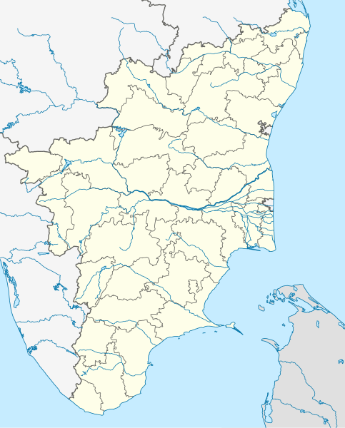
Deutsch: Postionskarte von Tamil Nadu
Quadratische Plattkarte. Geographische Begrenzung der Karte:
English: Location map of Tamil Nadu
Equirectangular projection. Geographic limits of the map:
|
| நாள் | |
| மூலம் | own work, using this file by Planemad |
| ஆசிரியர் | Maximilian Dörrbecker (Chumwa) |
| ஒத்தக்கோப்பு |
|


|
This map has been made or improved in the German Kartenwerkstatt (Map Lab). You can propose maps to improve as well.
|
அனுமதி
இந்த ஆக்கத்தின் காப்புரிமையாளரான நான் இதனைப் பின்வரும் உரிமத்தின் கீழ் வெளியிடுகின்றேன்:

|
GNU Free Documentation License விதிமுறைகளின் கீழ் இந்த ஆவணத்தை நகலெடுக்க, விநியோகிக்க மற்றும்/அல்லது மாற்றுவதற்கு அனுமதி வழங்கப்பட்டுள்ளது, Free Software Foundation;ஆல் வெளியிடப்பட்ட பதிப்பு 1.2 அல்லது அதற்குப் பிந்தைய பதிப்பு, மாற்றமில்லாத பிரிவுகள், முன் அட்டை உரைகள் மற்றும் பின் அட்டை உரைகள் இல்லாமல் வெளியிடப்பட்டது. GNU Free Documentation License என்ற தலைப்பில் உரிமத்தின் நகல் சேர்க்கப்பட்டுள்ளது. |
இந்த கோப்பு Creative Commons Attribution-Share Alike 3.0 Unported உரிமத்தின் கீழ் உள்ளது.
- நீங்கள் சுதந்திரமாக:
- பகிர்ந்து கொள்ள – வேலையை நகலெடுக்க, விநியோகிக்க மற்றும் அனுப்ப
- மீண்டும் கலக்க – வேலைக்கு பழகிக்கொள்ள.
- கீழ்க்காணும் விதிகளுக்கு ஏற்ப,
- பண்புக்கூறுகள் – நீங்கள் பொருத்தமான உரிமையை வழங்க வேண்டும், உரிமத்திற்கான இணைப்பை வழங்க வேண்டும் மற்றும் மாற்றங்கள் செய்யப்பட்டிருந்தால் குறிப்பிட வேண்டும். நீங்கள் ஏற்புடைய எந்த முறையிலும் அவ்வாறு செய்யலாம், ஆனால் எந்த வகையிலும் உரிமதாரர் உங்களை அல்லது உங்கள் பயன்பாட்டிற்கு ஒப்புதல் அளிக்கும் படி பரிந்துரைக்க கூடாது.
- அதே மாதிரி பகிர் – நீங்கள் ரீமிக்ஸ் செய்தாலோ, உருமாற்றம் செய்தாலோ அல்லது பொருளை உருவாக்கினாலோ, உங்கள் பங்களிப்புகளை அல்லது இணக்கமான உரிமம் கீழ் அசலாக விநியோகிக்க வேண்டும்.
நீர் உமக்கு விருப்பமான உரிமத்தை தேர்ந்தெடுக்கலாம்.
கோப்பின் வரலாறு
குறித்த நேரத்தில் இருந்த படிமத்தைப் பார்க்க அந்நேரத்தின் மீது சொடுக்கவும்.
| நாள்/நேரம் | நகம் அளவு சிறுபடம் | அளவுகள் | பயனர் | கருத்து | |
|---|---|---|---|---|---|
| தற்போதைய | 00:54, 6 செப்டெம்பர் 2021 | | 1,591 × 1,975 (840 KB) | C1MM | Corrected Tirunelveli/Tenkasi dist boundary |
| 16:43, 4 செப்டெம்பர் 2021 |  | 1,591 × 1,975 (840 KB) | C1MM | Resized file | |
| 06:09, 4 செப்டெம்பர் 2021 |  | 907 × 1,123 (880 KB) | C1MM | Removed extra river piece | |
| 04:35, 4 செப்டெம்பர் 2021 |  | 907 × 1,123 (880 KB) | C1MM | Corrected rivers and dist boundaries | |
| 16:44, 20 பெப்பிரவரி 2021 |  | 512 × 636 (727 KB) | C1MM | Corrected coastline | |
| 00:35, 18 திசம்பர் 2020 |  | 512 × 636 (257 KB) | C1MM | Relayered | |
| 22:06, 22 ஏப்பிரல் 2020 |  | 512 × 636 (373 KB) | C1MM | Restore colors | |
| 20:03, 22 ஏப்பிரல் 2020 |  | 512 × 636 (373 KB) | C1MM | Fixed colors and colored Pondicherry | |
| 14:18, 17 மார்ச்சு 2020 |  | 512 × 636 (250 KB) | C1MM | Reverted to version as of 14:17, 17 March 2020 (UTC) | |
| 14:18, 17 மார்ச்சு 2020 |  | 512 × 636 (249 KB) | C1MM | Reverted to version as of 03:04, 17 March 2020 (UTC) |
கோப்பு பயன்பாடு
100 க்கும் மேற்பட்ட பக்கத்தின் இணைப்பு இந்த கோப்பிற்கு உள்ளது.
கீழ்கண்ட பட்டியல் காட்டுவது, முதல் 100 பக்க இணைப்புகளை பக்கம், இந்த கோப்பிற்கு மட்டும். ஒரு முழு பட்டியல் உள்ளது.
- அகரம் (பேரூராட்சி)
- அண்ணாமலை நகர்
- அதிராம்பட்டினம்
- அத்திப்பட்டு
- அந்தியூர்
- அன்னவாசல்
- அம்பாசமுத்திரம்
- அம்மாப்பேட்டை
- அய்யம்பாளையம்
- அய்யலூர்
- அரக்கோணம்
- அரவக்குறிச்சி
- அரிமளம்
- அரியலூர்
- அருப்புக்கோட்டை
- அறந்தாங்கி
- அறுபடைவீடுகள்
- அழகியபாண்டியபுரம்
- ஆடுதுறை
- ஆனைமலை
- ஆம்பூர்
- ஆரணி (திருவள்ளூர் மாவட்டம்)
- ஆறுமுகநேரி
- ஆற்காடு
- ஆலங்குடி
- ஆலந்தூர்
- ஆவடி
- இரஞ்சன்குடி கோட்டை
- இராமேசுவரம்
- ஈரோடு
- உடுமலைப்பேட்டை
- உதகமண்டலம்
- எடப்பாடி
- எட்டயபுரம்
- எழுமலை
- கஞ்சனூர் அக்கினீஸ்வரர் கோயில்
- கடம்பூர்
- கடையநல்லூர்
- கண்ணமங்கலம்
- கம்பம்
- கரூர்
- கள்ளக்குறிச்சி
- கழுகுமலை
- காஞ்சிபுரம்
- காஞ்சிபுரம் ஏகாம்பரநாதர் கோயில்
- காஞ்சிபுரம் கைலாசநாதர் கோயில்
- காஞ்சிபுரம் திருமேற்றளீசுவரர் கோயில்
- காந்தி நகர் (திருவண்ணாமலை)
- கும்பகோணம்
- கும்பகோணம் ஆதி கும்பேசுவரர் கோயில்
- கொடைக்கானல்
- கொருக்கை வீரட்டேசுவரர் கோயில்
- கோயம்புத்தூர்
- சிதம்பரம் (நகரம்)
- சிவகாசி
- சென்னை
- தஞ்சாவூர்
- தஞ்சைப் பெருவுடையார் கோயில்
- தருமபுரி
- திண்டுக்கல்
- திருக்கழுக்குன்றம் வேதகிரீஸ்வரர் கோயில்
- திருக்கோழம்பியம் கோகிலேசுவரர் கோயில்
- திருச்சிராப்பள்ளி
- திருச்செந்தூர்
- திருநெல்வெண்ணெய்
- திருநெல்வேலி
- திருப்பரங்குன்றம் முருகன் கோவில்
- திருப்பூர்
- திருமங்கலக்குடி பிராணநாதேசுவரர் கோயில்
- திருமணஞ்சேரி உத்வாகநாதர் கோயில்
- திருமயம்
- திருவண்ணாமலை
- திருவாரூர்
- திருவையாறு
- தூத்துக்குடி
- தேரழுந்தூர் வேதபுரீசுவரர் கோயில்
- நாகப்பட்டினம்
- நாமக்கல்
- நார்த்தாமலை
- பழனி
- பழமுதிர்சோலை முருகன் கோயில்
- பவானி
- புனித டேவிட் கோட்டை
- பூண்டி ஊன்றீஸ்வரர் கோயில்
- பூதலூர்
- பூம்புகார் பல்லவனேசுவரர் கோயில்
- மணப்பாறை
- மதுரை
- மனோரா
- மயிலாடுதுறை
- மருதமலை
- மாமல்லபுரம்
- மாமல்லபுரம் கடற்கரைக் கோயில்
- மாமல்லபுரம் தலசயனப் பெருமாள் கோயில்
- மேலக்கடம்பூர் அமிர்தகடேஸ்வரர் கோயில்
- வடதிருமுல்லைவாயில் மாசிலாமணீசுவரர் கோயில்
- விருதுநகர்
- விழுப்புரம்
- வேலூர்
- பயனர்:Ganeshbot/மணல்தொட்டி/ஆரணி
இந்த கோப்பிற்கான அதிக இணைப்புகளை பார்.
கோப்பின் முழுமையான பயன்பாடு
கீழ்கண்ட மற்ற விக்கிகள் இந்த கோப்பை பயன்படுத்துகின்றன:
- ar.wikipedia.org-திட்டத்தில் இதன் பயன்பாடு
- as.wikipedia.org-திட்டத்தில் இதன் பயன்பாடு
- azb.wikipedia.org-திட்டத்தில் இதன் பயன்பாடு
- چنای
- باتی پاراسری
- باتی پینایور
- باتی کالاتور
- وینانجنی
- ویراوانور
- پیانویلای
- پتای, ویلوپورام
- پتای, کارایکال
- پتای, کودالور
- ویرامودایاناتام
- ویراسولاپورام
- ویراپانچاترام
- پرونقودی, تیروچیراپالی
- پرونقودی, پودوکوتای
- وانامادوی
- ساتانور
- ساتیوایال
- ساتیراکوندان
- ساتانور, پرامبالور
- ساراسواتی ناقار
- سانتیپالایام
- سانتاناقوپالاپورام
- سانانالور
- سانکاراپورام
- سانکاراپاندیاپورام
- کالاکودی
- کالییور
- کالینجییام
- ماتییامپاتی
- کالایور
- کالاتور ت
- دوغو کالاتور
- کالاتیمادام
- کالانقانی
- ماروقالپاتی
- مارودور, کویمباتور
- مارتاندانتورای
- کالاییور
- ساماناتام
- سامالپاتی
- سالوپاپاتی
- ونتریلینقاپورام
- سالیپری
- کاکیوادانپاتی
- ومباکام
சிறப்பு பக்கம்-மொத்த பயன்பாடு - இதன் மூலம் இந்த கோப்பின் மொத்த பயன்பாட்டை அறிய முடியும்