தென் அமெரிக்க நாடுகளின் பட்டியல்
Appearance

இப்பட்டியல் தென் அமெரிக்காவிலுள்ள இறைமையுள்ள நாடுகளையும் சார்பு மண்டலங்களையும் கொண்டுள்ளது.[1]
இறைமையுள்ள நாடுகள்
[தொகு]மேலதிக தகவலுக்கு: இறைமையுள்ள நாடு
தென் அமெரிக்க இறைமையுள்ள நாடுகள்:[2]
| கொடி | வரைபடம் | பெயர் [3][4][5] |
உள்ளூர்ப் பெயர் [3][4] |
தலைநகர் [5][6][7] |
மக்கள் தொகை [8] |
பரப்பு [9] |
|---|---|---|---|---|---|---|
 |
 |
அர்கெந்தீனா Argentine Republic |
எசுப்பானியம்: Argentina — República Argentina | புவெனஸ் ஐரிஸ் எசுப்பானியம்: Ciudad de Buenos Aires |
41,769,726 | 2,780,400 km2 (1,073,518 sq mi) |
 |
 |
பொலிவியா Plurinational State of Bolivia |
எசுப்பானியம்: Bolivia — Estado Plurinacional de Bolivia | Sucre எசுப்பானியம்: Sucre[n 1] |
10,118,683 | 1,098,581 km2 (424,164 sq mi) |
 |
 |
பிரேசில் Federative Republic of Brazil |
போர்த்துக்கேய மொழி: Brasil — República Federativa do Brasil | பிரசிலியா போர்த்துக்கேய மொழி: Brasília |
203,429,773 | 8,514,877 km2 (3,287,612 sq mi) |
 |
 |
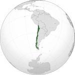
சிலி[n 2] Republic of Chile |
எசுப்பானியம்: Chile — República de Chile | Santiago[n 3] எசுப்பானியம்: Santiago |
16,888,760 | 756,102 km2 (291,933 sq mi) |
 |
 |
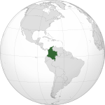
கொலொம்பியா Republic of Colombia |
எசுப்பானியம்: Colombia — República de Colombia | பொகோட்டா / Santa Fe de Bogotá எசுப்பானியம்: Bogotá |
46,366,364 | 1,138,910 km2 (439,736 sq mi) |
 |
 |
எக்குவடோர் Republic of Ecuador |
எசுப்பானியம்: Ecuador — República del Ecuador | கித்தோ எசுப்பானியம்: Quito |
15,007,343 | 283,561 km2 (109,484 sq mi) |
 |
 |
கயானா Co-operative Republic of Guyana |
ஆங்கில மொழி: Guyana — Co-operative Republic of Guyana | Georgetown எசுப்பானியம்: Georgetown |
744,768 | 214,969 km2 (83,000 sq mi) |
 |
 |
பரகுவை Republic of Paraguay |
எசுப்பானியம்: Paraguay — República del Paraguay வார்ப்புரு:Lang-gn |
அசுன்சியோன் எசுப்பானியம்: Asunción |
6,459,058 | 406,752 km2 (157,048 sq mi) |
 |
 |
பெரு Republic of Peru |
ஐமர: Perú வார்ப்புரு:Lang-qu எசுப்பானியம்: Perú — República del Perú |
லிமா எசுப்பானியம்: Lima |
29,248,943 | 1,285,216 km2 (496,225 sq mi) |
 |
 |
சுரிநாம் Republic of Suriname |
டச்சு: Suriname — Republiek Suriname | பரமாரிபோ டச்சு: Paramaribo |
491,989 | 163,820 km2 (63,251 sq mi) |
 |
 |
உருகுவை Eastern Republic of Uruguay[n 4] |
எசுப்பானியம்: Uruguay — República Oriental del Uruguay | மொண்டேவீடியோ எசுப்பானியம்: Montevideo |
3,308,535 | 176,215 km2 (68,037 sq mi) |
 |
 |
வெனிசுவேலா Bolivarian Republic of Venezuela |
எசுப்பானியம்: Venezuela — República Bolivariana de Venezuela | கரகஸ் எசுப்பானியம்: Caracas |
27,635,743 | 912,050 km2 (352,144 sq mi) |
இறைமையற்ற நாடுகள்
[தொகு]சார்பு மண்டலங்கள்
[தொகு]| கொடி | வரைபடம் | பெயர்[3][5] | நிலை | உள்ளூர்ப் பெயர் | தலைநகர்[6] | மக்கள் தொகை[8] | பரப்பு[9] |
|---|---|---|---|---|---|---|---|
 |
 |
போக்லாந்து தீவுகள் | பிரித்தானிய கடல் கடந்த ஆட்புலங்கள் | ஆங்கில மொழி: Falkland Islands | Stanley ஆங்கில மொழி: Stanley |
3,140 | 12,173 km2 (4,700 sq mi) |
 |
 |
தெற்கு யோர்சியா மற்றும் தெற்கு சண்ட்விச் தீவுகள்[n 5] | பிரித்தானிய கடல் கடந்த ஆட்புலங்கள் | ஆங்கில மொழி: South Georgia and the South Sandwich Islands | King Edward Point ஆங்கில மொழி: King Edward Point |
0 | 3,903 km2 (1,507 sq mi) |
பிற பகுதிகள்
[தொகு]| கொடி | வரைபடம் | பெயர்[3][5] | நிலை | உள்ளூர்ப் பெயர் | தலைநகர்[6] | மக்கள் தொகை[8] | பரப்பு[9] |
|---|---|---|---|---|---|---|---|
 |
 |
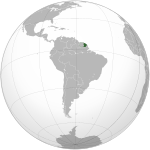
பிரெஞ்சு கயானா | பிரஞ்சு கடல் கடந்த ஆட்புலங்கள் | பிரெஞ்சு மொழி: Guyane | கயேன் பிரெஞ்சு மொழி: Cayenne |
2,50,109[10] | 83,534 km2 (32,253 sq mi) |
குறிப்புகள்
[தொகு]- ↑ While Sucre is the constitutional capital, லா பாஸ் is the seat of the government.
- ↑ Includes ஈஸ்டர் தீவு in the அமைதிப் பெருங்கடல், a சிலிan territory frequently reckoned in ஓசியானியா.
- ↑ While Santiago is the constitutional capital of Chile, வல்பெய்ரசோவ் is the site of legislative meetings.
- ↑ Also translated as "Oriental Republic of Uruguay".
- ↑ Sometimes grouped with அந்தாட்டிக்கா rather than South America
உசாத்துணை
[தொகு]- ↑ த நியூயார்க் டைம்ஸ் Guide to Essential Knowledge: A Desk Reference for the Curious Mind (2nd ed.), New York: St. Martin's Press, 2007, p. 598, பன்னாட்டுத் தரப்புத்தக எண் 0-312-37659-6, இணையக் கணினி நூலக மைய எண் 173243876
- ↑ Ashley, Richard K (1 சூன் 1988). "Untying the Sovereign State: A Double Reading of the Anarchy Problematique". Millennium – Journal of International Studies (Sage Journals Online) 17 (2): 227–262. doi:10.1177/03058298880170020901. http://mil.sagepub.com/content/17/2/227.short. பார்த்த நாள்: 15 பெப்ரவரி 2012.
- ↑ 3.0 3.1 3.2 3.3 "Field Listing :: Names". Central Intelligence Agency. Archived from the original on 2019-01-07. பார்க்கப்பட்ட நாள் 7 பெப்ரவரி 2012.
{{cite web}}: Check date values in:|accessdate=(help) - ↑ 4.0 4.1 "UNGEGN List of Country Names" (PDF). United Nations Statistics Division. 2007. பார்க்கப்பட்ட நாள் 2011-02-24.[தொடர்பிழந்த இணைப்பு]
- ↑ 5.0 5.1 5.2 5.3 "List of countries, territories and currencies". Europa. 7 பெப்ரவரி 2012. பார்க்கப்பட்ட நாள் 7 பெப்ரவரி 2012.
{{cite web}}: Check date values in:|accessdate=and|date=(help) - ↑ 6.0 6.1 6.2 "Field Listing :: Capital". Central Intelligence Agency. Archived from the original on 2018-12-25. பார்க்கப்பட்ட நாள் 7 பெப்ரவரி 2012.
{{cite web}}: Check date values in:|accessdate=(help) - ↑ "UNGEGN World Geographical Names". United Nations Group of Experts on Geographical Names. 9 திசம்பர் 2011. பார்க்கப்பட்ட நாள் 7 பெப்ரவரி 2012.
{{cite web}}: Check date values in:|accessdate=(help) - ↑ 8.0 8.1 8.2 "Country Comparison :: Population". Central Intelligence Agency. Archived from the original on 2011-09-27. பார்க்கப்பட்ட நாள் 7 பெப்ரவரி 2012.
{{cite web}}: Check date values in:|accessdate=(help) - ↑ 9.0 9.1 9.2 "Field Listing :: Area". Central Intelligence Agency. Archived from the original on 2014-01-31. பார்க்கப்பட்ட நாள் 7 பெப்ரவரி 2012.
{{cite web}}: Check date values in:|accessdate=(help) - ↑ INSEE. "Estimation de population au 1er janvier, par région, sexe et grande classe d'âge – Année 2013" (in French). பார்க்கப்பட்ட நாள் 2014-01-26.
{{cite web}}: CS1 maint: unrecognized language (link)
