
படிமம்:South India Map 1794.jpg
இந்த முன்னோட்டத்தின் அளவு: 442 × 599 படப்புள்ளிகள் . மற்ற பிரிதிறன்கள்: 177 × 240 படப்புள்ளிகள் | 354 × 480 படப்புள்ளிகள் | 567 × 768 படப்புள்ளிகள் | 755 × 1,024 படப்புள்ளிகள் | 1,511 × 2,048 படப்புள்ளிகள் | 3,400 × 4,608 படப்புள்ளிகள் .
மூலக்கோப்பு (3,400 × 4,608 படவணுக்கள், கோப்பின் அளவு: 2.59 MB, MIME வகை: image/jpeg)
| இது விக்கிமீடியா பொதுக்கோப்பகத்தில் இருக்கும் ஒரு கோப்பாகும். இக்கோப்பைக் குறித்து அங்கே காணப்படும் படிம விளக்கப் பக்கத்தை இங்கே கீழே காணலாம்.
|
சுருக்கம்
| Description |
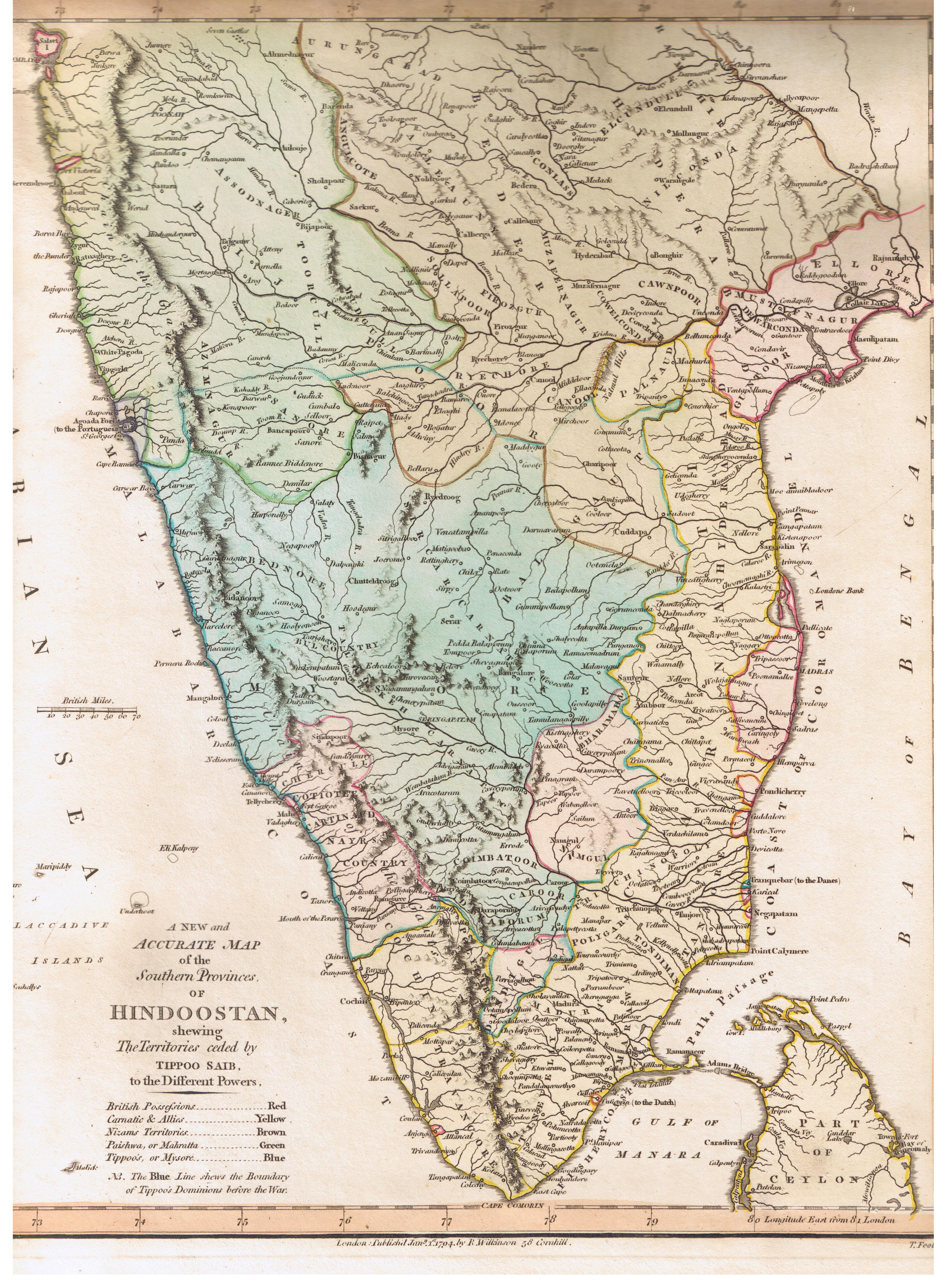
English: This map describes the political state of the Indian subcontinent after the Third Anglo-Mysore War.
Map is captioned as follows: A New and Accurate Map of the Southern Provinces of Hindoostan, shewing The Territories ceded by TIPOO SAHIB to the Different Powers |
|||||||||
| நாள் | ||||||||||
| மூலம் | Published by R. Wilkinson, 58 Cornhill, London | |||||||||
| படைப்பாளி |
T. Foot Sculp |
|||||||||
| அனுமதி (இக்கோப்பை மீண்டும் பயன்படுத்துதல்) |
public domain because of age | |||||||||
| Geotemporal data | ||||||||||
| Bounding box |
|
|||||||||
| Georeferencing | ||||||||||
| ஒத்தக்கோப்பு |
|
|||||||||

அனுமதி
|
This work is in the public domain in its country of origin and other countries and areas where the copyright term is the author's life plus 100 years or fewer. | |
| This file has been identified as being free of known restrictions under copyright law, including all related and neighboring rights. | |
கோப்பின் வரலாறு
குறித்த நேரத்தில் இருந்த படிமத்தைப் பார்க்க அந்நேரத்தின் மீது சொடுக்கவும்.
| நாள்/நேரம் | நகம் அளவு சிறுபடம் | அளவுகள் | பயனர் | கருத்து | |
|---|---|---|---|---|---|
| தற்போதைய | 16:57, 10 ஆகத்து 2007 | | 3,400 × 4,608 (2.59 MB) | Marcus334 | {{Information |Description= A New and Accurate Map of the Southern Provinces of Hindoostan, shewing The Territories ceded by TIPOO SAHIB to the Different Powers |Source= Published by R. Wilkinson, 58 Cornhill, London |Date= Jan 1, 1794 |Author= T. Foot Sc |
கோப்பு பயன்பாடு
பின்வரும் 6 பக்கங்கள் இணைப்பு இப் படிமத்துக்கு இணைக்கபட்டுள்ளது(ளன):
கோப்பின் முழுமையான பயன்பாடு
கீழ்கண்ட மற்ற விக்கிகள் இந்த கோப்பை பயன்படுத்துகின்றன:
- ar.wikipedia.org-திட்டத்தில் இதன் பயன்பாடு
- ca.wikipedia.org-திட்டத்தில் இதன் பயன்பாடு
- en.wikipedia.org-திட்டத்தில் இதன் பயன்பாடு
- vi.wikipedia.org-திட்டத்தில் இதன் பயன்பாடு