
படிமம்:Lebanon location map Topographic.png

இந்த முன்னோட்டத்தின் அளவு: 521 × 599 படப்புள்ளிகள் . மற்ற பிரிதிறன்கள்: 209 × 240 படப்புள்ளிகள் | 417 × 480 படப்புள்ளிகள் | 993 × 1,142 படப்புள்ளிகள் .
மூலக்கோப்பு (993 × 1,142 படவணுக்கள், கோப்பின் அளவு: 990 KB, MIME வகை: image/png)
| இது விக்கிமீடியா பொதுக்கோப்பகத்தில் இருக்கும் ஒரு கோப்பாகும். இக்கோப்பைக் குறித்து அங்கே காணப்படும் படிம விளக்கப் பக்கத்தை இங்கே கீழே காணலாம்.
|
சுருக்கம்
| Camera location | | View this and other nearby images on: OpenStreetMap |
|---|
| விளக்கம் |
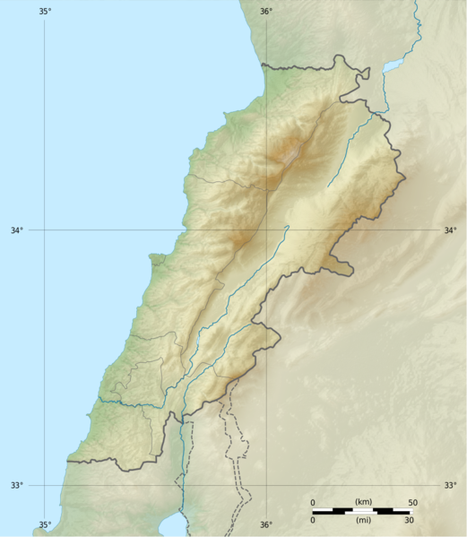
Deutsch: Positionskarte des Libanon
Quadratische Plattkarte, N-S-Streckung 115 %. Geographische Begrenzung der Karte: Français : Carte physique vierge du Liban, destinée à la géolocalisation.
Projection equirectangulaire, N/S stretching 115 %. Limites géographiques de la carte: English: Location map of Lebanon
Equirectangular projection, N/S stretching 115 %. Geographic limits of the map:
|
||
| நாள் | |||
| மூலம் |
Topographic background map: Own work
|
||
| ஆசிரியர் | Vivepat and NordNordWest | ||
| அனுமதி (இக்கோப்பை மீண்டும் பயன்படுத்துதல்) |
|
||
| ஒத்தக்கோப்பு |
|


அனுமதி
இந்த ஆக்கத்தின் காப்புரிமையாளரான நான் இதனைப் பின்வரும் உரிமத்தின் கீழ் வெளியிடுகின்றேன்:

|
Permission is granted to copy, distribute and/or modify this document under the terms of the GNU Free Documentation License, Version 1.2 only as published by the Free Software Foundation; with no Invariant Sections, no Front-Cover Texts, and no Back-Cover Texts. A copy of the license is included in the section entitled GNU Free Documentation License. | 1.2 மட்டுமே |
|
|
Permission is granted to copy, distribute and/or modify this document under the terms of the GNU Free Documentation License, Version 1.3 or any later version published by the Free Software Foundation; with no Invariant Sections, no Front-Cover Texts, and no Back-Cover Texts. A copy of the license is included in the section entitled GNU Free Documentation License.
|
If this file is eligible for relicensing, it may also be used under the Creative Commons Attribution-ShareAlike 3.0 license. The relicensing status of this image needs to be manually reviewed by an experienced user. You can help.
|
நீர் உமக்கு விருப்பமான உரிமத்தை தேர்ந்தெடுக்கலாம்.
கோப்பின் வரலாறு
குறித்த நேரத்தில் இருந்த படிமத்தைப் பார்க்க அந்நேரத்தின் மீது சொடுக்கவும்.
| நாள்/நேரம் | நகம் அளவு சிறுபடம் | அளவுகள் | பயனர் | கருத்து | |
|---|---|---|---|---|---|
| தற்போதைய | 06:17, 22 சூன் 2017 | | 993 × 1,142 (990 KB) | Vivepat | correction lat/lon |
| 06:10, 22 சூன் 2017 |  | 993 × 1,142 (990 KB) | Vivepat | Lattitude error correction | |
| 05:59, 22 சூன் 2017 |  | 993 × 1,142 (990 KB) | Vivepat | update of the map using the Wikipedia maps conventions | |
| 22:12, 15 சூன் 2012 |  | 1,581 × 1,818 (3.35 MB) | Dr Brains |
கோப்பு பயன்பாடு
பின்வரும் பக்க இணைப்புகள் இப் படிமத்துக்கு இணைக்கபட்டுள்ளது(ளன):
கோப்பின் முழுமையான பயன்பாடு
கீழ்கண்ட மற்ற விக்கிகள் இந்த கோப்பை பயன்படுத்துகின்றன:
- als.wikipedia.org-திட்டத்தில் இதன் பயன்பாடு
- an.wikipedia.org-திட்டத்தில் இதன் பயன்பாடு
- ar.wikipedia.org-திட்டத்தில் இதன் பயன்பாடு
- arz.wikipedia.org-திட்டத்தில் இதன் பயன்பாடு
- ast.wikipedia.org-திட்டத்தில் இதன் பயன்பாடு
- az.wikipedia.org-திட்டத்தில் இதன் பயன்பாடு
- bn.wikipedia.org-திட்டத்தில் இதன் பயன்பாடு
- bs.wikipedia.org-திட்டத்தில் இதன் பயன்பாடு
- ca.wikipedia.org-திட்டத்தில் இதன் பயன்பாடு
- ceb.wikipedia.org-திட்டத்தில் இதன் பயன்பாடு
- ce.wikipedia.org-திட்டத்தில் இதன் பயன்பாடு
- cs.wikipedia.org-திட்டத்தில் இதன் பயன்பாடு
- da.wikipedia.org-திட்டத்தில் இதன் பயன்பாடு
- el.wikipedia.org-திட்டத்தில் இதன் பயன்பாடு
- en.wikipedia.org-திட்டத்தில் இதன் பயன்பாடு
சிறப்பு பக்கம்-மொத்த பயன்பாடு - இதன் மூலம் இந்த கோப்பின் மொத்த பயன்பாட்டை அறிய முடியும்