
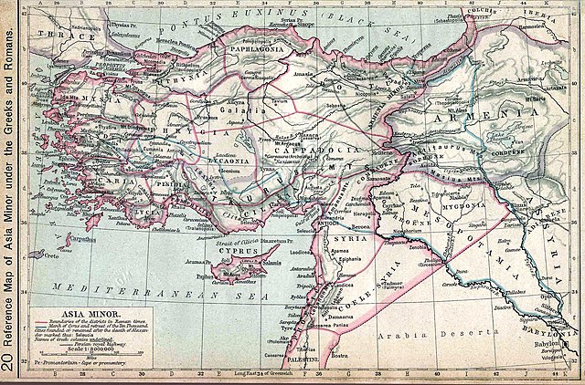
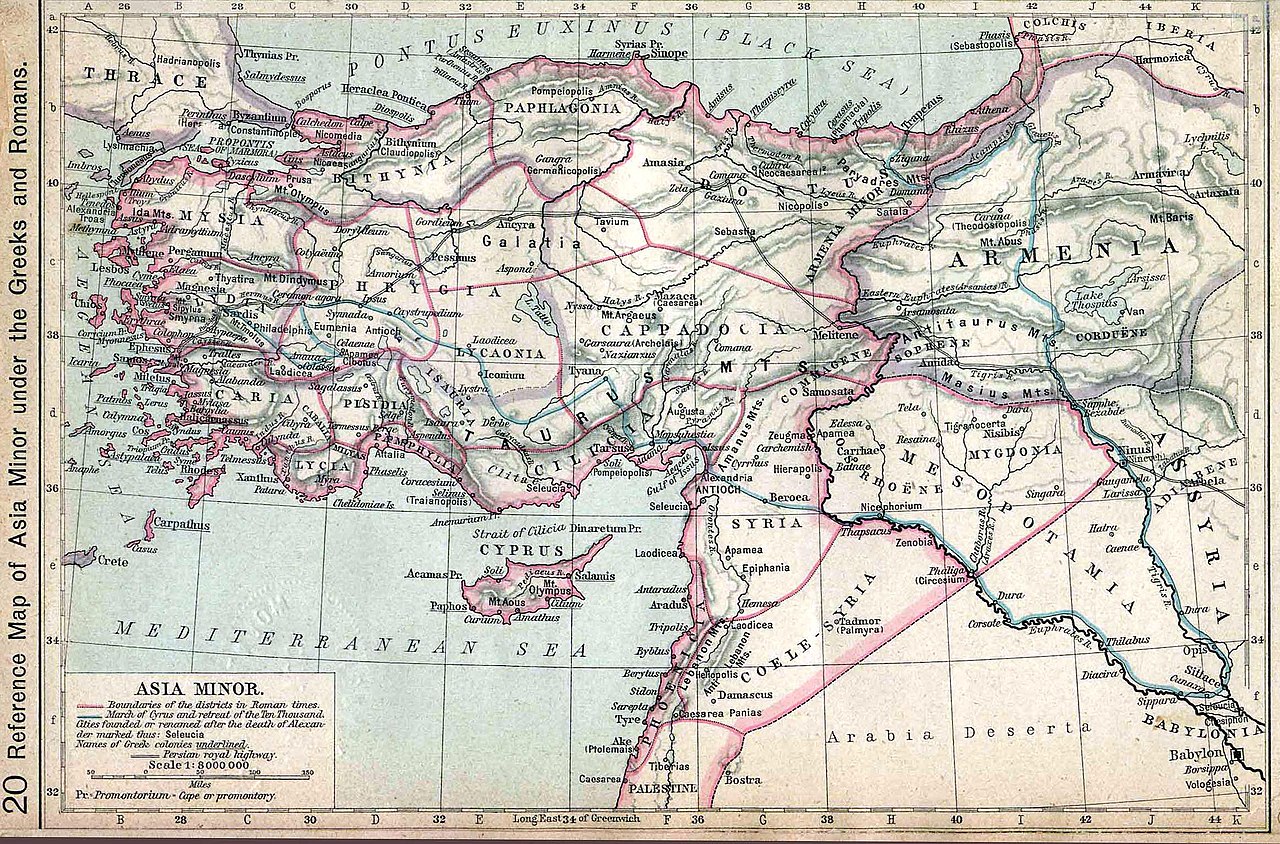
படிமம்:Asia minor p20.jpg

மூலக்கோப்பு (2,313 × 1,525 படவணுக்கள், கோப்பின் அளவு: 1.07 MB, MIME வகை: image/jpeg)
| இது விக்கிமீடியா பொதுக்கோப்பகத்தில் இருக்கும் ஒரு கோப்பாகும். இக்கோப்பைக் குறித்து அங்கே காணப்படும் படிம விளக்கப் பக்கத்தை இங்கே கீழே காணலாம்.
|
சுருக்கம்
| விளக்கம் | Map of Asia Minor. Historical Atlas | ||||||||||||||||||||||
| நாள் | |||||||||||||||||||||||
| மூலம் | http://www.lib.utexas.edu/maps/historical/history_shepherd_1911.html | ||||||||||||||||||||||
| ஆசிரியர் |
|
||||||||||||||||||||||
அனுமதி
|
This work is in the public domain in its country of origin and other countries and areas where the copyright term is the author's life plus 70 years or fewer.
| |
| This file has been identified as being free of known restrictions under copyright law, including all related and neighboring rights. | |
Original upload log
- 2006-06-07 09:13 Wirya 2350×1547× (406744 bytes) Asia minor under the Greeks and Romans. Map from: [http://www.lib.utexas.edu/maps/], Public Domain {{PD}}
கோப்பின் வரலாறு
குறித்த நேரத்தில் இருந்த படிமத்தைப் பார்க்க அந்நேரத்தின் மீது சொடுக்கவும்.
| நாள்/நேரம் | நகம் அளவு சிறுபடம் | அளவுகள் | பயனர் | கருத்து | |
|---|---|---|---|---|---|
| தற்போதைய | 04:44, 13 செப்டெம்பர் 2012 | | 2,313 × 1,525 (1.07 MB) | OgreBot | (BOT): Reverting to most recent version before archival |
| 04:44, 13 செப்டெம்பர் 2012 |  | 2,350 × 1,547 (397 KB) | OgreBot | (BOT): Uploading old version of file from en.wikipedia; originally uploaded on 2006-06-07 09:13:07 by Wirya | |
| 16:07, 14 சனவரி 2008 |  | 2,313 × 1,525 (1.07 MB) | Shakko | {{Information |Description=Map of Asia Minor. Historical Atlas |Source=http://www.lib.utexas.edu/maps/historical/history_shepherd_1911.html |Date=1911 |Author=en:William R. Shepherd († 1934) |Permission= |other_versions= }} Category:Cappadocia |
கோப்பு பயன்பாடு
பின்வரும் பக்க இணைப்புகள் இப் படிமத்துக்கு இணைக்கபட்டுள்ளது(ளன):
கோப்பின் முழுமையான பயன்பாடு
கீழ்கண்ட மற்ற விக்கிகள் இந்த கோப்பை பயன்படுத்துகின்றன:
- als.wikipedia.org-திட்டத்தில் இதன் பயன்பாடு
- ar.wikipedia.org-திட்டத்தில் இதன் பயன்பாடு
- ba.wikipedia.org-திட்டத்தில் இதன் பயன்பாடு
- bg.wikipedia.org-திட்டத்தில் இதன் பயன்பாடு
- br.wikipedia.org-திட்டத்தில் இதன் பயன்பாடு
- bs.wikipedia.org-திட்டத்தில் இதன் பயன்பாடு
- cs.wikipedia.org-திட்டத்தில் இதன் பயன்பாடு
- da.wikipedia.org-திட்டத்தில் இதன் பயன்பாடு
- de.wikipedia.org-திட்டத்தில் இதன் பயன்பாடு
- dsb.wikipedia.org-திட்டத்தில் இதன் பயன்பாடு
- el.wikipedia.org-திட்டத்தில் இதன் பயன்பாடு
- en.wikipedia.org-திட்டத்தில் இதன் பயன்பாடு
- fi.wikipedia.org-திட்டத்தில் இதன் பயன்பாடு
- incubator.wikimedia.org-திட்டத்தில் இதன் பயன்பாடு
- it.wikipedia.org-திட்டத்தில் இதன் பயன்பாடு
- ku.wikipedia.org-திட்டத்தில் இதன் பயன்பாடு
- la.wikipedia.org-திட்டத்தில் இதன் பயன்பாடு
- pl.wikipedia.org-திட்டத்தில் இதன் பயன்பாடு
- pl.wiktionary.org-திட்டத்தில் இதன் பயன்பாடு
- pnt.wikipedia.org-திட்டத்தில் இதன் பயன்பாடு
- ro.wikipedia.org-திட்டத்தில் இதன் பயன்பாடு
- ru.wikipedia.org-திட்டத்தில் இதன் பயன்பாடு
- sh.wikipedia.org-திட்டத்தில் இதன் பயன்பாடு
- sl.wikipedia.org-திட்டத்தில் இதன் பயன்பாடு
- sr.wikipedia.org-திட்டத்தில் இதன் பயன்பாடு
- tr.wikipedia.org-திட்டத்தில் இதன் பயன்பாடு
சிறப்பு பக்கம்-மொத்த பயன்பாடு - இதன் மூலம் இந்த கோப்பின் மொத்த பயன்பாட்டை அறிய முடியும்