
படிமம்:Gilgit-Baltistan map with tehsils labelled.png

இந்த முன்னோட்டத்தின் அளவு: 800 × 399 படப்புள்ளிகள் . மற்ற பிரிதிறன்கள்: 320 × 160 படப்புள்ளிகள் | 640 × 319 படப்புள்ளிகள் | 1,024 × 511 படப்புள்ளிகள் | 1,280 × 639 படப்புள்ளிகள் | 2,560 × 1,278 படப்புள்ளிகள் | 8,058 × 4,022 படப்புள்ளிகள் .
மூலக்கோப்பு (8,058 × 4,022 படவணுக்கள், கோப்பின் அளவு: 1.47 MB, MIME வகை: image/png)
| இது விக்கிமீடியா பொதுக்கோப்பகத்தில் இருக்கும் ஒரு கோப்பாகும். இக்கோப்பைக் குறித்து அங்கே காணப்படும் படிம விளக்கப் பக்கத்தை இங்கே கீழே காணலாம்.
|
சுருக்கம்
| விளக்கம் |
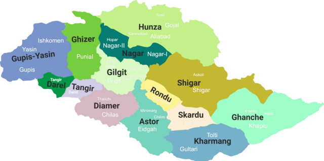
English: Gilgit-Baltistan map with tehsils labelled |
| நாள் | (updated 2019) |
| மூலம் | சொந்த முயற்சி |
| ஆசிரியர் | Kazmi |
அனுமதி
இந்த ஆக்கத்தின் காப்புரிமையாளரான நான் இதனைப் பின்வரும் உரிமத்தின் கீழ் வெளியிடுகின்றேன்:
This file is licensed under the Creative Commons Attribution-Share Alike 4.0 International license.
- நீங்கள் சுதந்திரமாக:
- பகிர்ந்து கொள்ள – வேலையை நகலெடுக்க, விநியோகிக்க மற்றும் அனுப்ப
- மீண்டும் கலக்க – வேலைக்கு பழகிக்கொள்ள.
- கீழ்க்காணும் விதிகளுக்கு ஏற்ப,
- பண்புக்கூறுகள் – நீங்கள் பொருத்தமான உரிமையை வழங்க வேண்டும், உரிமத்திற்கான இணைப்பை வழங்க வேண்டும் மற்றும் மாற்றங்கள் செய்யப்பட்டிருந்தால் குறிப்பிட வேண்டும். நீங்கள் ஏற்புடைய எந்த முறையிலும் அவ்வாறு செய்யலாம், ஆனால் எந்த வகையிலும் உரிமதாரர் உங்களை அல்லது உங்கள் பயன்பாட்டிற்கு ஒப்புதல் அளிக்கும் படி பரிந்துரைக்க கூடாது.
- அதே மாதிரி பகிர் – நீங்கள் ரீமிக்ஸ் செய்தாலோ, உருமாற்றம் செய்தாலோ அல்லது பொருளை உருவாக்கினாலோ, உங்கள் பங்களிப்புகளை அல்லது இணக்கமான உரிமம் கீழ் அசலாக விநியோகிக்க வேண்டும்.
கோப்பின் வரலாறு
குறித்த நேரத்தில் இருந்த படிமத்தைப் பார்க்க அந்நேரத்தின் மீது சொடுக்கவும்.
| நாள்/நேரம் | நகம் அளவு சிறுபடம் | அளவுகள் | பயனர் | கருத்து | |
|---|---|---|---|---|---|
| தற்போதைய | 10:14, 19 சூன் 2019 | | 8,058 × 4,022 (1.47 MB) | Kazmi | Added missing details - district Tangir and Darel - Added names of main localities |
| 01:19, 19 சூன் 2019 |  | 8,058 × 4,022 (1.36 MB) | Kazmi | Added names and redefined the boundaries of newly established districts | |
| 01:50, 28 சூன் 2017 |  | 1,952 × 997 (80 KB) | Kazmi | User created page with UploadWizard |
கோப்பு பயன்பாடு
பின்வரும் 8 பக்கங்கள் இணைப்பு இப் படிமத்துக்கு இணைக்கபட்டுள்ளது(ளன):
கோப்பின் முழுமையான பயன்பாடு
கீழ்கண்ட மற்ற விக்கிகள் இந்த கோப்பை பயன்படுத்துகின்றன:
- bn.wikipedia.org-திட்டத்தில் இதன் பயன்பாடு
- en.wikipedia.org-திட்டத்தில் இதன் பயன்பாடு
- Masherbrum
- Kanjut Sar
- Haramosh Peak
- Distaghil Sar
- Chogolisa
- Districts of Pakistan
- Zarabod
- Sust
- Gilgit Agency
- Gasherbrum III
- Gasherbrum IV
- Baintha Brakk
- Hispar Muztagh
- Batbaykor
- Diran
- Kunyang Chhish
- Shispare
- Batura Sar
- Malubiting
- K6 (mountain)
- Shigar River
- Astore Wildlife Sanctuary
- Baltistan Wildlife Sanctuary
- Laila Peak (Haramosh Valley)
- Laila Peak (Rupal Valley)
- Passu Sar
- Taghafari
- Snow Dome, Concordia
- Rakaposhi-Haramosh Mountains
- Askole
- Panmah Muztagh
- Hispar Glacier
- Astore Valley
- Ghanche District
- Skardu District
- Gilgit District
- Diamer District
சிறப்பு பக்கம்-மொத்த பயன்பாடு - இதன் மூலம் இந்த கோப்பின் மொத்த பயன்பாட்டை அறிய முடியும்