
படிமம்:WWII-Mediterranean-v1.PNG
இதைவிட அளவில் பெரிய படிமம் இல்லை.
WWII-Mediterranean-v1.PNG (800 × 448 படவணுக்கள், கோப்பின் அளவு: 113 KB, MIME வகை: image/png)
| இது விக்கிமீடியா பொதுக்கோப்பகத்தில் இருக்கும் ஒரு கோப்பாகும். இக்கோப்பைக் குறித்து அங்கே காணப்படும் படிம விளக்கப் பக்கத்தை இங்கே கீழே காணலாம்.
|
சுருக்கம்
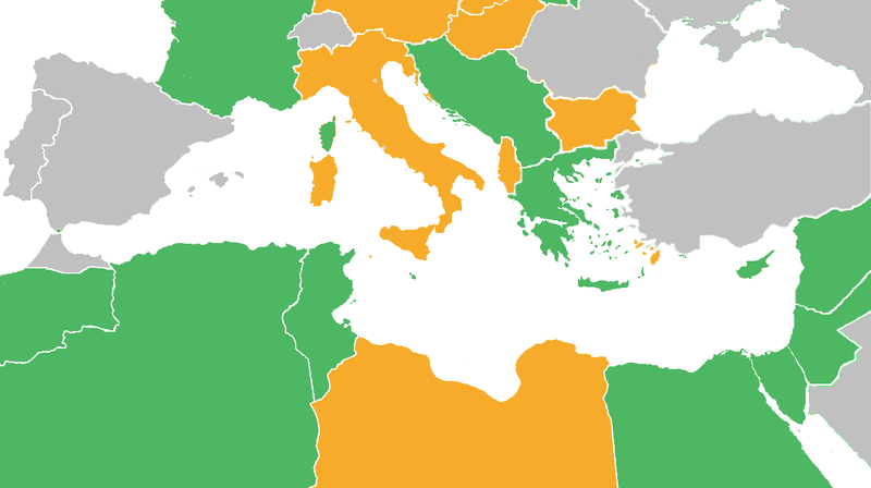
| விளக்கம் |
Map with the Participants in World War II:
|
| நாள் | |
| மூலம் | derived from Image:BlankMap-World6.svg |
| ஆசிரியர் | derived from User:Canuckguy's map |
அனுமதி
இந்த ஆக்கத்தின் காப்புரிமையாளரான Reuv at the English Wikipedia எனும் நான் இதனைப் பின்வரும் உரிமத்தின் கீழ் வெளியிடுகின்றேன்:

|
GNU Free Documentation License விதிமுறைகளின் கீழ் இந்த ஆவணத்தை நகலெடுக்க, விநியோகிக்க மற்றும்/அல்லது மாற்றுவதற்கு அனுமதி வழங்கப்பட்டுள்ளது, Free Software Foundation;ஆல் வெளியிடப்பட்ட பதிப்பு 1.2 அல்லது அதற்குப் பிந்தைய பதிப்பு, மாற்றமில்லாத பிரிவுகள், முன் அட்டை உரைகள் மற்றும் பின் அட்டை உரைகள் இல்லாமல் வெளியிடப்பட்டது. GNU Free Documentation License என்ற தலைப்பில் உரிமத்தின் நகல் சேர்க்கப்பட்டுள்ளது. |
| இந்த கோப்பு Creative Commons Attribution-Share Alike 3.0 Unported உரிமத்தின் கீழ் உள்ளது. | ||
| பண்புக்கூறுகள்: Reuv at the English Wikipedia | ||
| ||
| This licensing tag was added to this file as part of the GFDL licensing update. |
Original upload log
The original description page was here. All following user names refer to en.wikipedia.
- 2011-06-21 03:34 Theirrulez 800×448× (125554 bytes) Borders corrections for Italy, Vichy's Government and Turkey
- 2009-07-18 07:32 Reuv 1305×731× (28321 bytes) Adressed the problems brought up in discussion.
- 2007-10-14 14:29 Reuv 1305×731× (45623 bytes) == Summary == {{Information |Description= map of the Mediterranean theatre of operations in WWII. |Source= derived from [[:Image:BlankMap-World6.svg|Image:BlankMap-World6.svg]] |Date= October 2007 |Author= derived from [[User:Canuckguy]]'s map |Permission
கோப்பின் வரலாறு
குறித்த நேரத்தில் இருந்த படிமத்தைப் பார்க்க அந்நேரத்தின் மீது சொடுக்கவும்.
| நாள்/நேரம் | நகம் அளவு சிறுபடம் | அளவுகள் | பயனர் | கருத்து | |
|---|---|---|---|---|---|
| தற்போதைய | 15:22, 10 மே 2012 | | 800 × 448 (113 KB) | OgreBot | (BOT): Reverting to most recent version before archival |
| 15:22, 10 மே 2012 |  | 1,305 × 731 (28 KB) | OgreBot | (BOT): Uploading old version of file from en.wikipedia; originally uploaded on 2009-07-18 07:32:35 by Reuv | |
| 15:22, 10 மே 2012 |  | 1,305 × 731 (45 KB) | OgreBot | (BOT): Uploading old version of file from en.wikipedia; originally uploaded on 2007-10-14 14:29:14 by Reuv | |
| 17:20, 27 அக்டோபர் 2011 |  | 800 × 448 (113 KB) | Spiridon Ion Cepleanu | Rectifications : borders 1940-1940 (before June 1940) and countrie's status. | |
| 16:25, 21 சூன் 2011 |  | 800 × 448 (123 KB) | Gigillo83 | Borders I-YU | |
| 17:33, 20 சூன் 2011 |  | 800 × 448 (123 KB) | Gigillo83 | Borders corrections for Italy, Vichy's Government and Turkey | |
| 11:59, 7 அக்டோபர் 2009 |  | 800 × 448 (111 KB) | JJ Georges | {{Information |Description=Maps of Mediterranean operations in World War II |Source=http://en.wikipedia.org/wiki/File:WWII-Mediterranean-v1.PNG |Date=10/2007 |Author=http://en.wikipedia.org/wiki/User:Canuckguy |Permission= |other_versions= }} |
கோப்பு பயன்பாடு
பின்வரும் 2 பக்கங்கள் இணைப்பு இப் படிமத்துக்கு இணைக்கபட்டுள்ளது(ளன):
கோப்பின் முழுமையான பயன்பாடு
கீழ்கண்ட மற்ற விக்கிகள் இந்த கோப்பை பயன்படுத்துகின்றன:
- ar.wikipedia.org-திட்டத்தில் இதன் பயன்பாடு
- ca.wikipedia.org-திட்டத்தில் இதன் பயன்பாடு
- en.wikipedia.org-திட்டத்தில் இதன் பயன்பாடு
- eo.wikipedia.org-திட்டத்தில் இதன் பயன்பாடு
- es.wikipedia.org-திட்டத்தில் இதன் பயன்பாடு
- eu.wikipedia.org-திட்டத்தில் இதன் பயன்பாடு
- fa.wikipedia.org-திட்டத்தில் இதன் பயன்பாடு
- fi.wikipedia.org-திட்டத்தில் இதன் பயன்பாடு
- fr.wikipedia.org-திட்டத்தில் இதன் பயன்பாடு
- he.wikipedia.org-திட்டத்தில் இதன் பயன்பாடு
- hr.wikipedia.org-திட்டத்தில் இதன் பயன்பாடு
- it.wikipedia.org-திட்டத்தில் இதன் பயன்பாடு
- ko.wikipedia.org-திட்டத்தில் இதன் பயன்பாடு
- lt.wikipedia.org-திட்டத்தில் இதன் பயன்பாடு
- ms.wikipedia.org-திட்டத்தில் இதன் பயன்பாடு
- no.wikipedia.org-திட்டத்தில் இதன் பயன்பாடு
- ru.wikipedia.org-திட்டத்தில் இதன் பயன்பாடு
- sr.wikipedia.org-திட்டத்தில் இதன் பயன்பாடு
- th.wikipedia.org-திட்டத்தில் இதன் பயன்பாடு
- tr.wikipedia.org-திட்டத்தில் இதன் பயன்பாடு
- vi.wikipedia.org-திட்டத்தில் இதன் பயன்பாடு
- zh.wikipedia.org-திட்டத்தில் இதன் பயன்பாடு