
படிமம்:Map of Russia - Ural Federal District (2018 composition).svg

Size of this PNG preview of this SVG file: 800 × 462 படப்புள்ளிகள். மற்ற பிரிதிறன்கள்: 320 × 185 படப்புள்ளிகள் | 640 × 369 படப்புள்ளிகள் | 1,024 × 591 படப்புள்ளிகள் | 1,280 × 738 படப்புள்ளிகள் | 2,560 × 1,477 படப்புள்ளிகள் | 1,092 × 630 படப்புள்ளிகள் .
மூலக்கோப்பு (SVG கோப்பு, பெயரளவில் 1,092 × 630 பிக்சல்கள், கோப்பு அளவு: 61 KB)
| இது விக்கிமீடியா பொதுக்கோப்பகத்தில் இருக்கும் ஒரு கோப்பாகும். இக்கோப்பைக் குறித்து அங்கே காணப்படும் படிம விளக்கப் பக்கத்தை இங்கே கீழே காணலாம்.
|
.svg)
சுருக்கம்
| விளக்கம் |
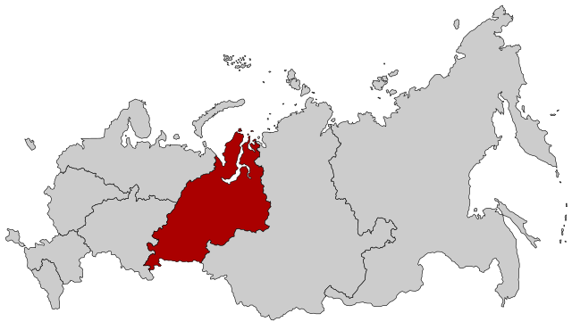
English: Map Russia highlighting the Ural Federal district as of 2018-11-03. Español: Ubicación del Distrito Federal de los Urales en la Federación Rusa Русский: Уральский федеральный округ |
| நாள் | (UTC) |
| மூலம் |
This file was derived from: |
| ஆசிரியர் |
.svg)
| இது ஒரு திருத்தப்பட்ட படிமமாகும், அதாவது இதன் மூல வடிவத்திலிருந்து கணினி மூலம் இதில் மாற்றங்கள் செய்யப்பட்டுள்ளது. திருத்தங்கள்: Change of Far Eastern and Siberian district membership. மூலக்கோப்பை இங்கு காணலாம்: Map of Russia - Far Eastern Federal District (2018 composition).svg. திருத்தங்களைச் செய்தவர் Seryo93.
|
அனுமதி
This file is licensed under the Creative Commons Attribution-Share Alike 2.5 Generic license.
- நீங்கள் சுதந்திரமாக:
- பகிர்ந்து கொள்ள – வேலையை நகலெடுக்க, விநியோகிக்க மற்றும் அனுப்ப
- மீண்டும் கலக்க – வேலைக்கு பழகிக்கொள்ள.
- கீழ்க்காணும் விதிகளுக்கு ஏற்ப,
- பண்புக்கூறுகள் – நீங்கள் பொருத்தமான உரிமையை வழங்க வேண்டும், உரிமத்திற்கான இணைப்பை வழங்க வேண்டும் மற்றும் மாற்றங்கள் செய்யப்பட்டிருந்தால் குறிப்பிட வேண்டும். நீங்கள் ஏற்புடைய எந்த முறையிலும் அவ்வாறு செய்யலாம், ஆனால் எந்த வகையிலும் உரிமதாரர் உங்களை அல்லது உங்கள் பயன்பாட்டிற்கு ஒப்புதல் அளிக்கும் படி பரிந்துரைக்க கூடாது.
- அதே மாதிரி பகிர் – நீங்கள் ரீமிக்ஸ் செய்தாலோ, உருமாற்றம் செய்தாலோ அல்லது பொருளை உருவாக்கினாலோ, உங்கள் பங்களிப்புகளை அல்லது இணக்கமான உரிமம் கீழ் அசலாக விநியோகிக்க வேண்டும்.
Original upload log
This image is a derivative work of the following images:
- File:Map of Russia - Urals Federal District.svg licensed with Cc-by-sa-2.5
- 2015-03-10T14:20:10Z Knyaz-1988 1092x630 (97434 Bytes) Reverted to version as of 22:07, 3 November 2014
- 2014-11-04T01:32:38Z Fry1989 1092x630 (120528 Bytes) NPOV issue.
- 2014-11-03T22:07:29Z Knyaz-1988 1092x630 (97434 Bytes) New version
- 2010-01-21T22:28:10Z Denhud 1092x630 (120528 Bytes) On 2010-01-19 Southern Federal District split in two, with its former southern territories forming new North Caucasian Federal District.
- 2008-03-03T23:37:06Z Lokal Profil 1092x630 (114976 Bytes) {{Information |Description=Map Russia highlighting the Urals [[:en:Federal districts of Russia|Federal districts]]. |Source=Based on [[:Image:Map of Russian subjects, 2008-03-01.svg|Map of Russian subjects, 2008-03-01.svg]] b
- File:Map of Russia - Far Eastern Federal District (2018 composition).svg licensed with Cc-by-sa-2.5
- 2018-11-04T19:15:28Z Seryo93 1092x630 (62312 Bytes) == {{int:filedesc}} == {{Information |Description={{en|Map Russia highlighting the '''Far Eastern [[:en:Federal districts of Russia|Federal district]]''' as of 2018-11-03.}} {{es|Ubicación del Distrito Federal de Lejano Orie
Uploaded with derivativeFX
கோப்பின் வரலாறு
குறித்த நேரத்தில் இருந்த படிமத்தைப் பார்க்க அந்நேரத்தின் மீது சொடுக்கவும்.
| நாள்/நேரம் | நகம் அளவு சிறுபடம் | அளவுகள் | பயனர் | கருத்து | |
|---|---|---|---|---|---|
| தற்போதைய | 13:59, 2 திசம்பர் 2018 | | 1,092 × 630 (61 KB) | Seryo93 | == {{int:filedesc}} == {{Information |Description={{en|Map Russia highlighting the Ural Federal district as of 2018-11-03.}} {{es|Ubicación del Distrito Federal de los Urales en la Federación Rusa}} {{Ru|Уральский федеральный округ}} |Source={{Derived from|Map of Russia - Urals Federal District.svg|Map of Russia - Far Eastern Federal District (2018 composition).svg|display=50}} |Date=2018-12-02 13:58 (UTC) |Author= * [[:File:Map of Russia - Urals Federal Di... |
கோப்பு பயன்பாடு
பின்வரும் பக்க இணைப்புகள் இப் படிமத்துக்கு இணைக்கபட்டுள்ளது(ளன):
கோப்பின் முழுமையான பயன்பாடு
கீழ்கண்ட மற்ற விக்கிகள் இந்த கோப்பை பயன்படுத்துகின்றன:
- cs.wikipedia.org-திட்டத்தில் இதன் பயன்பாடு
- cv.wikipedia.org-திட்டத்தில் இதன் பயன்பாடு
- en.wikipedia.org-திட்டத்தில் இதன் பயன்பாடு
- en.wikinews.org-திட்டத்தில் இதன் பயன்பாடு
- frr.wikipedia.org-திட்டத்தில் இதன் பயன்பாடு
- fr.wikipedia.org-திட்டத்தில் இதன் பயன்பாடு
- lld.wikipedia.org-திட்டத்தில் இதன் பயன்பாடு
- lt.wikipedia.org-திட்டத்தில் இதன் பயன்பாடு
- lv.wikipedia.org-திட்டத்தில் இதன் பயன்பாடு
- no.wikipedia.org-திட்டத்தில் இதன் பயன்பாடு
- ru.wikipedia.org-திட்டத்தில் இதன் பயன்பாடு
- sl.wikipedia.org-திட்டத்தில் இதன் பயன்பாடு
- uz.wikipedia.org-திட்டத்தில் இதன் பயன்பாடு
- vi.wikipedia.org-திட்டத்தில் இதன் பயன்பாடு
- wuu.wikipedia.org-திட்டத்தில் இதன் பயன்பாடு
.svg)