
படிமம்:Albania location map.svg

Size of this PNG preview of this SVG file: 411 × 599 படப்புள்ளிகள். மற்ற பிரிதிறன்கள்: 165 × 240 படப்புள்ளிகள் | 329 × 480 படப்புள்ளிகள் | 527 × 768 படப்புள்ளிகள் | 703 × 1,024 படப்புள்ளிகள் | 1,406 × 2,048 படப்புள்ளிகள் | 688 × 1,002 படப்புள்ளிகள் .
மூலக்கோப்பு (SVG கோப்பு, பெயரளவில் 688 × 1,002 பிக்சல்கள், கோப்பு அளவு: 168 KB)
| இது விக்கிமீடியா பொதுக்கோப்பகத்தில் இருக்கும் ஒரு கோப்பாகும். இக்கோப்பைக் குறித்து அங்கே காணப்படும் படிம விளக்கப் பக்கத்தை இங்கே கீழே காணலாம்.
|
சுருக்கம்
| விளக்கம் |
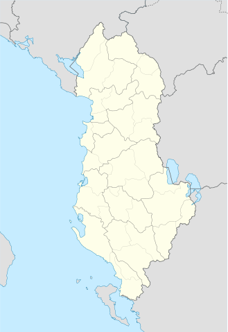
Deutsch: Positionskarte von Albanien
Quadratische Plattkarte, N-S-Streckung 130 %. Geographische Begrenzung der Karte:
English: Location map of Albania
Equirectangular projection, N/S stretching 130 %. Geographic limits of the map:
|
||
| நாள் | |||
| மூலம் | Own work using: United States National Imagery and Mapping Agency data | ||
| ஆசிரியர் | Lencer | ||
| SVG genesis | This locator map was created with Adobe Illustrator.
|

அனுமதி
இந்த ஆக்கத்தின் காப்புரிமையாளரான நான் இதனைப் பின்வரும் உரிமத்தின் கீழ் வெளியிடுகின்றேன்:

|
GNU Free Documentation License விதிமுறைகளின் கீழ் இந்த ஆவணத்தை நகலெடுக்க, விநியோகிக்க மற்றும்/அல்லது மாற்றுவதற்கு அனுமதி வழங்கப்பட்டுள்ளது, Free Software Foundation;ஆல் வெளியிடப்பட்ட பதிப்பு 1.2 அல்லது அதற்குப் பிந்தைய பதிப்பு, மாற்றமில்லாத பிரிவுகள், முன் அட்டை உரைகள் மற்றும் பின் அட்டை உரைகள் இல்லாமல் வெளியிடப்பட்டது. GNU Free Documentation License என்ற தலைப்பில் உரிமத்தின் நகல் சேர்க்கப்பட்டுள்ளது. |
இந்த கோப்பு Creative Commons Attribution-Share Alike 3.0 Unported உரிமத்தின் கீழ் உள்ளது.
- நீங்கள் சுதந்திரமாக:
- பகிர்ந்து கொள்ள – வேலையை நகலெடுக்க, விநியோகிக்க மற்றும் அனுப்ப
- மீண்டும் கலக்க – வேலைக்கு பழகிக்கொள்ள.
- கீழ்க்காணும் விதிகளுக்கு ஏற்ப,
- பண்புக்கூறுகள் – நீங்கள் பொருத்தமான உரிமையை வழங்க வேண்டும், உரிமத்திற்கான இணைப்பை வழங்க வேண்டும் மற்றும் மாற்றங்கள் செய்யப்பட்டிருந்தால் குறிப்பிட வேண்டும். நீங்கள் ஏற்புடைய எந்த முறையிலும் அவ்வாறு செய்யலாம், ஆனால் எந்த வகையிலும் உரிமதாரர் உங்களை அல்லது உங்கள் பயன்பாட்டிற்கு ஒப்புதல் அளிக்கும் படி பரிந்துரைக்க கூடாது.
- அதே மாதிரி பகிர் – நீங்கள் ரீமிக்ஸ் செய்தாலோ, உருமாற்றம் செய்தாலோ அல்லது பொருளை உருவாக்கினாலோ, உங்கள் பங்களிப்புகளை அல்லது இணக்கமான உரிமம் கீழ் அசலாக விநியோகிக்க வேண்டும்.
நீர் உமக்கு விருப்பமான உரிமத்தை தேர்ந்தெடுக்கலாம்.
கோப்பின் வரலாறு
குறித்த நேரத்தில் இருந்த படிமத்தைப் பார்க்க அந்நேரத்தின் மீது சொடுக்கவும்.
| நாள்/நேரம் | நகம் அளவு சிறுபடம் | அளவுகள் | பயனர் | கருத்து | |
|---|---|---|---|---|---|
| தற்போதைய | 19:16, 20 சூன் 2011 | | 688 × 1,002 (168 KB) | Vinie007 | fix districts |
| 20:56, 22 மார்ச்சு 2010 |  | 685 × 1,002 (152 KB) | NordNordWest | counties | |
| 20:06, 22 மார்ச்சு 2010 |  | 685 × 1,002 (162 KB) | NordNordWest | update | |
| 16:27, 11 செப்டெம்பர் 2008 |  | 685 × 1,002 (278 KB) | Lencer | {{Information |Description= |Source= |Date= |Author= |Permission= |other_versions= }} | |
| 18:36, 9 செப்டெம்பர் 2008 |  | 685 × 1,002 (278 KB) | Lencer | {{Information |Description= |Source= |Date= |Author= |Permission= |other_versions= }} | |
| 12:14, 16 ஆகத்து 2008 |  | 685 × 1,002 (279 KB) | Lencer | {{Information |Description= |Source= |Date= |Author= |Permission= |other_versions= }} | |
| 17:00, 21 சூலை 2008 |  | 258 × 377 (254 KB) | Lencer | {{Information |Description= |Source= |Date= |Author= |Permission= |other_versions= }} | |
| 16:42, 21 சூலை 2008 |  | 258 × 377 (254 KB) | Lencer | {{Information |Description= {{de|Positionskarte von Albanien}} Quadratische Plattkarte, N-S-Streckung 130 %. Geographische Begrenzung der Karte: * N: 42.9° N * S: 39.3° N * W: 18.3° O * O: 21.5° O {{en|Location map of [[:en:Al |
கோப்பு பயன்பாடு
இப் படிமத்துக்கு இணைக்கப்பட்டுள்ள பக்கங்கள் எதுவும் இல்லை.
கோப்பின் முழுமையான பயன்பாடு
கீழ்கண்ட மற்ற விக்கிகள் இந்த கோப்பை பயன்படுத்துகின்றன:
- ar.wikipedia.org-திட்டத்தில் இதன் பயன்பாடு
- bn.wikipedia.org-திட்டத்தில் இதன் பயன்பாடு
- bs.wikipedia.org-திட்டத்தில் இதன் பயன்பாடு
- ca.wikipedia.org-திட்டத்தில் இதன் பயன்பாடு
- ceb.wikipedia.org-திட்டத்தில் இதன் பயன்பாடு
- Albanya
- Plantilya:Location map Albania
- Puka
- Krabi
- Komsi
- Kalja
- Kala
- Golo
- Kusha
- Tok
- Raba
- Paula
- Kota
- Korab
- Orle
- Bistrica
- Tumba
- Mali i Zi
- Guri i Zi
- Veternik
- Selce
- Propas
- Petran
- Dibra
- Osoj
- Ostrovica
- Miras
- Mali Grad
- Mala Reka
- Lofka
- Lisec
- Lipec
- Leska
- Lomnica
- Kraste
- Krasta
- Kovacica
- Gorica
- Maja e Kodres
- Klisura
- Belica
சிறப்பு பக்கம்-மொத்த பயன்பாடு - இதன் மூலம் இந்த கோப்பின் மொத்த பயன்பாட்டை அறிய முடியும்