படிமம்:Roman Empire 125.png

மற்ற மொழிகளில் ஆதரிக்கப்படாத பக்க உள்ளடக்கம்.
கட்டற்ற கலைக்களஞ்சியமான விக்கிப்பீடியாவில் இருந்து.

மூலக்கோப்பு(2,186 × 1,817 படவணுக்கள், கோப்பின் அளவு: 4.43 MB, MIME வகை: image/png)

இது விக்கிமீடியா பொதுக்கோப்பகத்தில் இருக்கும் ஒரு கோப்பாகும். இக்கோப்பைக் குறித்து அங்கே காணப்படும் படிம விளக்கப் பக்கத்தை இங்கே கீழே காணலாம்.
பொதுக்கோப்பகம் ஒரு கட்டற்ற கோப்புகளின் சேமிப்பகமாகும். நீங்களும் உதவலாம்.
Camera location45° 00′ 00″ N, 20° 00′ 00″ E Kartographer map based on OpenStreetMap.View this and other nearby images on: OpenStreetMapinfo

சுருக்கம்

விளக்கம்
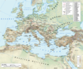
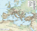
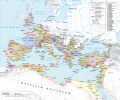
English: Map of the Roman Empire in 125 during the reign of emperor Hadrian, with anachronistic Germanic tribes from the time of Augustus.

Projection

Lambert azimuthal-equal area. Central latitude: 45° N, central longitude: 20° E. X, Y origin offset - 0

Datum: ETRS89

Sources

The physical map was made using the following public domain sources:

Additional references for the map content:

  • Tacitus, Germania (ca. 100)
  • Ptolemy, Geographia (ca. 140)
  • Atlante storico DeAgostini, Instituto Geografico DeAgostini, 1998. pg. 35-41.
  • Historischer Weltatlas, Dr. Walter Leisering, Marix Verlag, 2011. pg. 26-27
  • Történelmi világatlasz, Cartographia Kiadó, 2005. pg. 20-21.
  • The Penguin Historical Atlas of Ancient Rome by Christopher Scarre, Penguin Historical Atlases, 1995. pg. 81.

Software used

GIS:

Graphics editors:

நாள்
மூலம் சொந்த முயற்சி
ஆசிரியர்
அனுமதி
(இக்கோப்பை மீண்டும் பயன்படுத்துதல்)
Any use of this map can be made as long as you credit the author, Andrei N. (Wikipedia Commons user Andrein), and distribute the copies and derivative works under the same license as that the one stated below.
ஒத்தக்கோப்பு [தொகு]

Template loop detected: Template:Autotranslate <includeonly></includeonly>

General map
Political map

அனுமதி

இந்த ஆக்கத்தின் காப்புரிமையாளரான நான் இதனைப் பின்வரும் உரிமத்தின் கீழ் வெளியிடுகின்றேன்:
w:ta:கிரியேட்டிவ் காமன்ஸ்
பண்புக்கூறுகள் அதே மாதிரி பகிர்
இந்த கோப்பு Creative Commons Attribution-Share Alike 3.0 Unported உரிமத்தின் கீழ் உள்ளது.
நீங்கள் சுதந்திரமாக:
  • பகிர்ந்து கொள்ள – வேலையை நகலெடுக்க, விநியோகிக்க மற்றும் அனுப்ப
  • மீண்டும் கலக்க – வேலைக்கு பழகிக்கொள்ள.
கீழ்க்காணும் விதிகளுக்கு ஏற்ப,
  • பண்புக்கூறுகள் – நீங்கள் பொருத்தமான உரிமையை வழங்க வேண்டும், உரிமத்திற்கான இணைப்பை வழங்க வேண்டும் மற்றும் மாற்றங்கள் செய்யப்பட்டிருந்தால் குறிப்பிட வேண்டும். நீங்கள் ஏற்புடைய எந்த முறையிலும் அவ்வாறு செய்யலாம், ஆனால் எந்த வகையிலும் உரிமதாரர் உங்களை அல்லது உங்கள் பயன்பாட்டிற்கு ஒப்புதல் அளிக்கும் படி பரிந்துரைக்க கூடாது.
  • அதே மாதிரி பகிர் – நீங்கள் ரீமிக்ஸ் செய்தாலோ, உருமாற்றம் செய்தாலோ அல்லது பொருளை உருவாக்கினாலோ, உங்கள் பங்களிப்புகளை அல்லது இணக்கமான உரிமம் கீழ் அசலாக விநியோகிக்க வேண்டும்.
GNU head GNU Free Documentation License விதிமுறைகளின் கீழ் இந்த ஆவணத்தை நகலெடுக்க, விநியோகிக்க மற்றும்/அல்லது மாற்றுவதற்கு அனுமதி வழங்கப்பட்டுள்ளது, Free Software Foundation;ஆல் வெளியிடப்பட்ட பதிப்பு 1.2 அல்லது அதற்குப் பிந்தைய பதிப்பு, மாற்றமில்லாத பிரிவுகள், முன் அட்டை உரைகள் மற்றும் பின் அட்டை உரைகள் இல்லாமல் வெளியிடப்பட்டது. GNU Free Documentation License என்ற தலைப்பில் உரிமத்தின் நகல் சேர்க்கப்பட்டுள்ளது.
நீர் உமக்கு விருப்பமான உரிமத்தை தேர்ந்தெடுக்கலாம்.
Maps of the history of Europe
BCE
aC

Weichselian ice age (c. 113,000–9700) · Neolithic expansion (c. 7000–4500) · Middle Neolithic (c. 4500–4000) · Late Neolithic (c. 4000–3000) · Copper Age – Corded Ware culture (c. 2900–2350) · Copper Age – Bellbeaker culture (c. 2800–1800) · Early Bronze Age – Unetice culture (c. 2300–1600) · Late Bronze Age – Urnfield culture (c. 1300—750) · Migrations (c. 1000–100) · Hallstatt & La Tène cultures (c. 800–100) · Roman Republic (510–40) · 220 · 218 · 200 · 201–100 · 58 · 49 · 39 · 30 BCE–6 CE


CE
dC

14 · 14–37 · 60 · 60 · 69 · 80 · Migrations 100–500 · 117 · 117 · 125 · Migrations 150–774 · Economy 180 · 271 · 293–305 · 337 · 395 · c. 395 · 400 · 400 · 450 · 457–61 · 476 · 480 · Franks 481–814 · Early Slavs 500–700 · 500 · 526 · 526–600 · Christianisation to 600 · c. 550 · 650 · Pontic Steppe 650 · 665 · 800 · Vikings 800–1050 · 814 · 843–70 · 850 · 900 · 912 · 998 · 1000 · 1000 · 1054 · 1092 · First Crusade 1095–99 · 1097 · 1135 · 1142 · 1147–49 · 1190 · 1190 · 1250 · c. 1250 · 1301-1400 · 1301-1400 · 1328 · 1345 · Black Plague 1347–51 · 1360 · 1400 · Trade routes c. 1400 · 1430 · 1470 · 1490 · 1492 · 1500 · 1519 · 1550 · 1560 · Religion 1560 · Religion 1600 · Religion 1618 · 1618–48 · 1648 · 1683 · 1700 · 1701 · 1708 · 1714 · 1721 · 1725–30 · 1739–1740 · 1740 · 1748–66 · 1783–1792 · 1787 · 1787 · 1789 · 1799 · 1812 · 1812 · 1812 · 1812 · 1813 · 1815 · 1815 · 1815 · 1818 · Ottoman Empire 1830–1923 · 1848–49 · 1861 · 1867 · 1871 · 1878 · 1890 · 1905 · 1911 · 1914 · 1914 · 1919 · 1919–29 · 1923 · 1929 · 1930 · 1940 · 1941–42 · 1942–45 · Cold War 1947–91 · 1950 · 1993–2006 · 2006 to date

(this template: · view · discuss )

Captions

Add a one-line explanation of what this file represents
The Roman empire under Hadrian (ruled 117–138) showing the location of roads, cities, provincial boundaries, naval bases, the Roman legions deployed in 125 AD and Germanic tribes from the time of Augustus

Items portrayed in this file

depicts ஆங்கிலம்

copyright status ஆங்கிலம்

copyrighted ஆங்கிலம்

source of file ஆங்கிலம்

original creation by uploader ஆங்கிலம்

coordinates of the point of view ஆங்கிலம்

45°0'0.000"N, 20°0'0.000"E

கோப்பின் வரலாறு

குறித்த நேரத்தில் இருந்த படிமத்தைப் பார்க்க அந்நேரத்தின் மீது சொடுக்கவும்.

(மிகப் புதிய | மிகப் பழைய) (புதிய 10 | ) (10 | 20 | 50 | 100 | 250 | 500) பக்கங்களைப் பார்.
நாள்/நேரம்நகம் அளவு சிறுபடம்அளவுகள்பயனர்கருத்து
தற்போதைய19:34, 12 சனவரி 201919:34, 12 சனவரி 2019 இலிருந்த பதிப்புக்கான சிறு தோற்றம்2,186 × 1,817 (4.43 MB)ArdadNThis purpose of this map is not to represent ancient shorelines. Please upload a separate file with your original contributions!
16:18, 17 செப்டெம்பர் 201816:18, 17 செப்டெம்பர் 2018 இலிருந்த பதிப்புக்கான சிறு தோற்றம்2,186 × 1,817 (4.37 MB)Julieta39Shorelines of the time (Westermann Grosser Atlas zur Weltgeschichte, Braunschweig 1985, p. 36, 38, 39, ISBN 3-14-10-0919-8 and Andrein' s [https://commons.wikimedia.org/wiki/File:Danube_Delta_evolution.gif] since L. Giosan).
18:16, 20 சூலை 201518:16, 20 சூலை 2015 இலிருந்த பதிப்புக்கான சிறு தோற்றம்2,186 × 1,817 (4.43 MB)ArdadN1
17:49, 20 சூலை 201517:49, 20 சூலை 2015 இலிருந்த பதிப்புக்கான சிறு தோற்றம்2,186 × 1,817 (4.43 MB)ArdadN1
18:47, 3 மார்ச்சு 201518:47, 3 மார்ச்சு 2015 இலிருந்த பதிப்புக்கான சிறு தோற்றம்2,186 × 1,817 (4.43 MB)ArdadNfixing text problems
17:06, 3 மார்ச்சு 201517:06, 3 மார்ச்சு 2015 இலிருந்த பதிப்புக்கான சிறு தோற்றம்2,186 × 1,817 (4.38 MB)ArdadNnew road added
13:26, 10 பெப்பிரவரி 201513:26, 10 பெப்பிரவரி 2015 இலிருந்த பதிப்புக்கான சிறு தோற்றம்2,186 × 1,817 (4.43 MB)ArdadN1
18:45, 20 மே 201418:45, 20 மே 2014 இலிருந்த பதிப்புக்கான சிறு தோற்றம்2,186 × 1,817 (4.43 MB)ArdadN1
18:20, 9 ஏப்பிரல் 201418:20, 9 ஏப்பிரல் 2014 இலிருந்த பதிப்புக்கான சிறு தோற்றம்2,186 × 1,817 (4.43 MB)ArdadNScotti
15:39, 30 மார்ச்சு 201415:39, 30 மார்ச்சு 2014 இலிருந்த பதிப்புக்கான சிறு தோற்றம்2,186 × 1,817 (4.43 MB)ArdadN1
(மிகப் புதிய | மிகப் பழைய) (புதிய 10 | ) (10 | 20 | 50 | 100 | 250 | 500) பக்கங்களைப் பார்.

பின்வரும் 3 பக்கங்கள் இணைப்பு இப் படிமத்துக்கு இணைக்கபட்டுள்ளது(ளன):

கோப்பின் முழுமையான பயன்பாடு

கீழ்கண்ட மற்ற விக்கிகள் இந்த கோப்பை பயன்படுத்துகின்றன:

சிறப்பு பக்கம்-மொத்த பயன்பாடு - இதன் மூலம் இந்த கோப்பின் மொத்த பயன்பாட்டை அறிய முடியும்

மேனிலைத் தரவு

"https://ta.wikipedia.org/wiki/படிமம்:Roman_Empire_125.png" இலிருந்து மீள்விக்கப்பட்டது