
படிமம்:Location Portugal EU Europe.png
இந்த முன்னோட்டத்தின் அளவு: 714 × 600 படப்புள்ளிகள் . மற்ற பிரிதிறன்கள்: 286 × 240 படப்புள்ளிகள் | 572 × 480 படப்புள்ளிகள் | 915 × 768 படப்புள்ளிகள் | 1,219 × 1,024 படப்புள்ளிகள் | 2,048 × 1,720 படப்புள்ளிகள் .
மூலக்கோப்பு (2,048 × 1,720 படவணுக்கள், கோப்பின் அளவு: 239 KB, MIME வகை: image/png)
| இது விக்கிமீடியா பொதுக்கோப்பகத்தில் இருக்கும் ஒரு கோப்பாகும். இக்கோப்பைக் குறித்து அங்கே காணப்படும் படிம விளக்கப் பக்கத்தை இங்கே கீழே காணலாம்.
|
Template loop detected: Template:Autotranslate <includeonly></includeonly>
சுருக்கம்
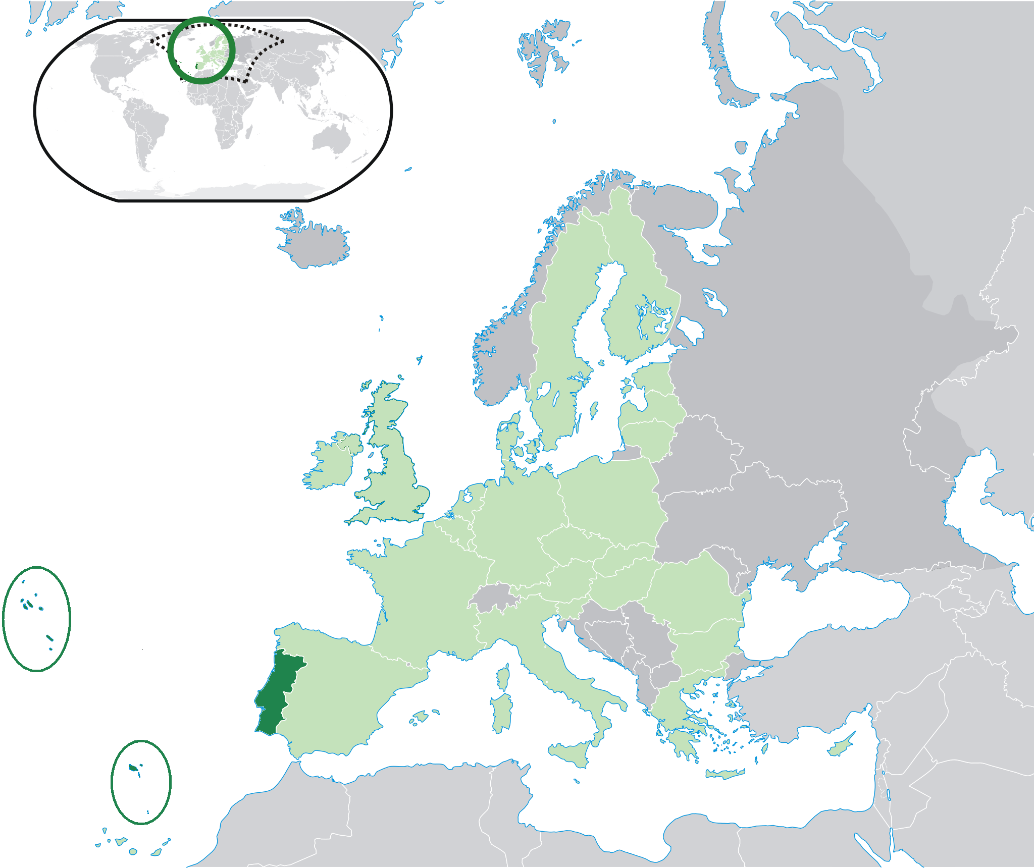
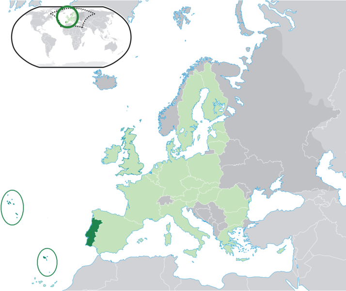
| விளக்கம் | Location map: Portugal (dark green) / European Union (light green) / Europe (dark grey); inspired by and consistent with general country locator maps by User:Vardion, et al. |
| நாள் | |
| மூலம் | சொந்த முயற்சி |
| ஆசிரியர் | Quizimodo |
| ஒத்தக்கோப்பு |
|


அனுமதி
| This work has been released into the public domain by its author, I, Quizimodo. This applies worldwide. சில நாடுகளில் இது சாத்தியமில்லாது போகலாம். அவ்வாறாயின் : I, Quizimodo grants anyone the right to use this work for any purpose, without any conditions, unless such conditions are required by law. |
கோப்பின் வரலாறு
குறித்த நேரத்தில் இருந்த படிமத்தைப் பார்க்க அந்நேரத்தின் மீது சொடுக்கவும்.
| நாள்/நேரம் | நகம் அளவு சிறுபடம் | அளவுகள் | பயனர் | கருத்து | |
|---|---|---|---|---|---|
| தற்போதைய | 19:47, 26 சூலை 2009 | | 2,048 × 1,720 (239 KB) | The Ogre | Small correction |
| 14:37, 24 சூலை 2009 |  | 2,048 × 1,720 (241 KB) | The Ogre | Still better visivility of islans (in agreement with the fact that the Savage islands ar a part of the Madeira archipelago) | |
| 14:30, 24 சூலை 2009 |  | 2,048 × 1,720 (241 KB) | The Ogre | Better visibility of islands in the Atlantic | |
| 14:13, 24 சூலை 2009 |  | 2,048 × 1,720 (240 KB) | The Ogre | Small corrections - included the islands of Corvo and Flores in the Azores, and the Desertas and Savage islands in Madeira. | |
| 01:06, 18 சூன் 2007 |  | 2,056 × 1,710 (176 KB) | Quizimodo~commonswiki | image (updated) | |
| 10:13, 17 சூன் 2007 |  | 2,056 × 1,710 (227 KB) | Quizimodo~commonswiki | image (tweaked) | |
| 10:06, 17 சூன் 2007 |  | 2,056 × 1,710 (227 KB) | Quizimodo~commonswiki | image (tweaked) | |
| 07:53, 17 சூன் 2007 |  | 2,056 × 1,710 (227 KB) | Quizimodo~commonswiki | image (tweaked) | |
| 07:18, 17 சூன் 2007 |  | 2,056 × 1,710 (223 KB) | Quizimodo~commonswiki | image (tweaked) | |
| 06:45, 17 சூன் 2007 |  | 2,056 × 1,710 (227 KB) | Quizimodo~commonswiki | {{Information |Description=Location map: Portugal (dark green) / European Union (light green) / Europe (dark grey); inspired by and consistent with general country locator maps by User:Vardion, et al |Source=self-made |Date= |Author= [[User:Quizimodo|Quiz |
கோப்பு பயன்பாடு
இப் படிமத்துக்கு இணைக்கப்பட்டுள்ள பக்கங்கள் எதுவும் இல்லை.
கோப்பின் முழுமையான பயன்பாடு
கீழ்கண்ட மற்ற விக்கிகள் இந்த கோப்பை பயன்படுத்துகின்றன:
- bcl.wikipedia.org-திட்டத்தில் இதன் பயன்பாடு
- ceb.wikipedia.org-திட்டத்தில் இதன் பயன்பாடு
- de.wikinews.org-திட்டத்தில் இதன் பயன்பாடு
- dv.wikipedia.org-திட்டத்தில் இதன் பயன்பாடு
- dz.wikipedia.org-திட்டத்தில் இதன் பயன்பாடு
- es.wikipedia.org-திட்டத்தில் இதன் பயன்பாடு
- es.wikiquote.org-திட்டத்தில் இதன் பயன்பாடு
- eu.wiktionary.org-திட்டத்தில் இதன் பயன்பாடு
- fr.wikipedia.org-திட்டத்தில் இதன் பயன்பாடு
- gag.wikipedia.org-திட்டத்தில் இதன் பயன்பாடு
- got.wikipedia.org-திட்டத்தில் இதன் பயன்பாடு
- gu.wikipedia.org-திட்டத்தில் இதன் பயன்பாடு
- ka.wikipedia.org-திட்டத்தில் இதன் பயன்பாடு
- kn.wikipedia.org-திட்டத்தில் இதன் பயன்பாடு
- ku.wiktionary.org-திட்டத்தில் இதன் பயன்பாடு
- no.wikipedia.org-திட்டத்தில் இதன் பயன்பாடு
- pl.wiktionary.org-திட்டத்தில் இதன் பயன்பாடு
- pt.wikinews.org-திட்டத்தில் இதன் பயன்பாடு
- ro.wikipedia.org-திட்டத்தில் இதன் பயன்பாடு
- ro.wikibooks.org-திட்டத்தில் இதன் பயன்பாடு
- te.wikipedia.org-திட்டத்தில் இதன் பயன்பாடு
- ug.wikipedia.org-திட்டத்தில் இதன் பயன்பாடு
- zh-classical.wikipedia.org-திட்டத்தில் இதன் பயன்பாடு