
படிமம்:Kingdom of England.png
இந்த முன்னோட்டத்தின் அளவு: 586 × 599 படப்புள்ளிகள் . மற்ற பிரிதிறன்கள்: 235 × 240 படப்புள்ளிகள் | 470 × 480 படப்புள்ளிகள் | 751 × 768 படப்புள்ளிகள் | 1,218 × 1,245 படப்புள்ளிகள் .
மூலக்கோப்பு (1,218 × 1,245 படவணுக்கள், கோப்பின் அளவு: 20 KB, MIME வகை: image/png)
| இது விக்கிமீடியா பொதுக்கோப்பகத்தில் இருக்கும் ஒரு கோப்பாகும். இக்கோப்பைக் குறித்து அங்கே காணப்படும் படிம விளக்கப் பக்கத்தை இங்கே கீழே காணலாம்.
|
| விளக்கம் |
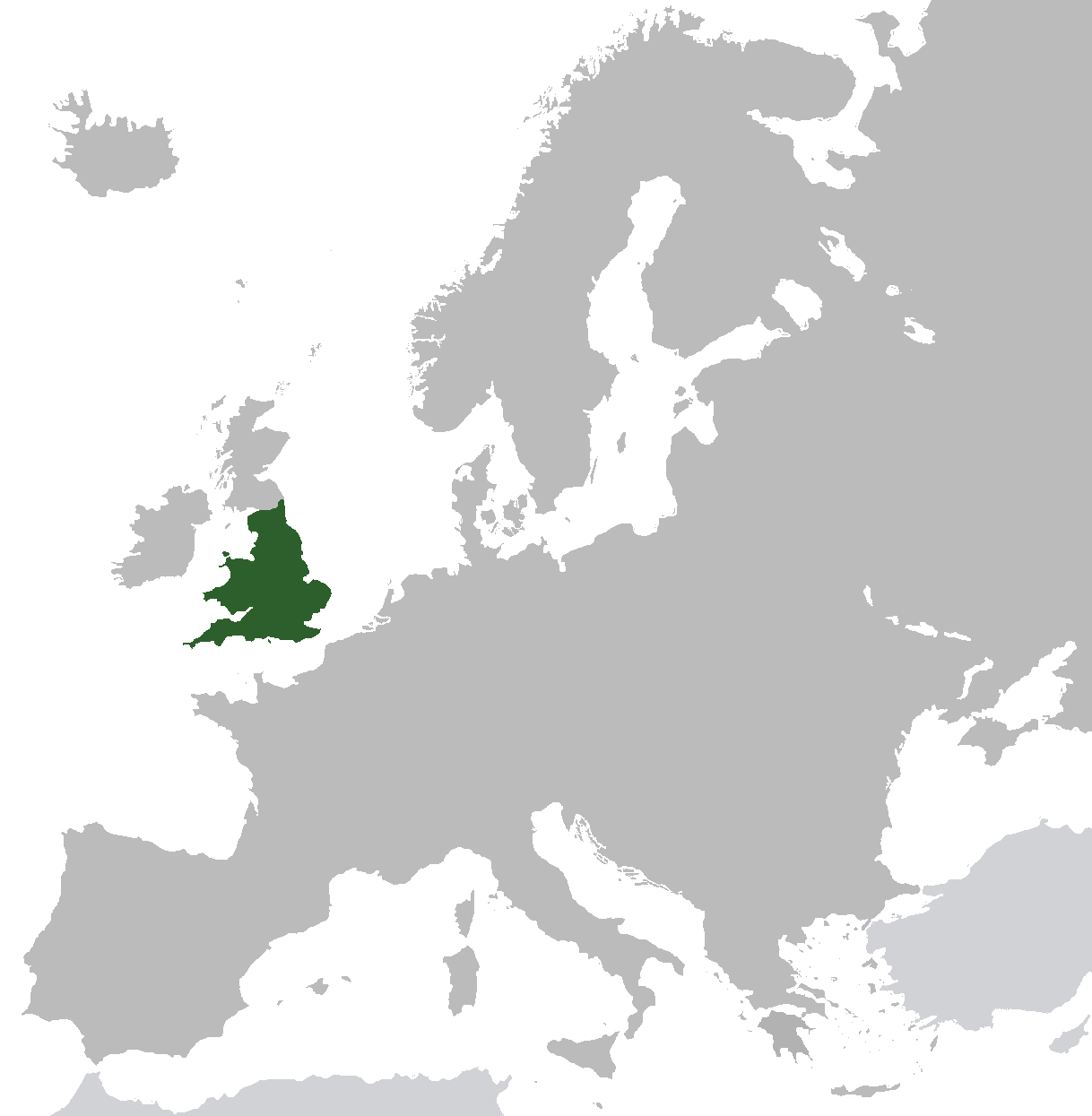
English: Map of the Kingdom of England from ca. 1282 to 1603. Does not include islands attached to the crown, but not incorporated into England, or varying territories in France. |
| நாள் | |
| மூலம் | சொந்த முயற்சி (Original text: I created this work entirely by myself.) |
| ஆசிரியர் | Gav235 (talk) |
அனுமதி
| This work has been released into the public domain by its author, Gav235 at ஆங்கிலம் விக்கிப்பீடியா. This applies worldwide. சில நாடுகளில் இது சாத்தியமில்லாது போகலாம். அவ்வாறாயின் : Gav235 grants anyone the right to use this work for any purpose, without any conditions, unless such conditions are required by law. |
Original upload log
Transferred from en.wikipedia to Commons by Broadbeer using CommonsHelper.
The original description page was here. All following user names refer to en.wikipedia.
- 2009-07-12 17:25 Gav235 1218×1245× (62805 bytes) {{Information |Description = Map of the Kingdom of England |Source = I created this work entirely by myself. |Date = 12 July 2009 |Author = ~~~ |other_versions = }}
கோப்பின் வரலாறு
குறித்த நேரத்தில் இருந்த படிமத்தைப் பார்க்க அந்நேரத்தின் மீது சொடுக்கவும்.
| நாள்/நேரம் | நகம் அளவு சிறுபடம் | அளவுகள் | பயனர் | கருத்து | |
|---|---|---|---|---|---|
| தற்போதைய | 06:35, 10 நவம்பர் 2014 | | 1,218 × 1,245 (20 KB) | AnonMoos | increasing PNG compression |
| 12:20, 20 பெப்பிரவரி 2014 |  | 1,218 × 1,245 (132 KB) | Rob984 | Non-European regions light grey | |
| 07:16, 23 செப்டெம்பர் 2012 |  | 1,218 × 1,245 (39 KB) | TRAJAN 117 | Standardise colours, minor fixes. | |
| 21:38, 12 திசம்பர் 2010 |  | 1,218 × 1,245 (39 KB) | VEO15 | Isle of Man + Danish border | |
| 12:48, 6 ஏப்பிரல் 2010 |  | 1,218 × 1,245 (39 KB) | Hayden120 | Corrected Cyprus. | |
| 20:13, 26 அக்டோபர் 2009 |  | 1,218 × 1,245 (61 KB) | File Upload Bot (Magnus Manske) | {{BotMoveToCommons|en.wikipedia|year={{subst:CURRENTYEAR}}|month={{subst:CURRENTMONTHNAME}}|day={{subst:CURRENTDAY}}}} {{Information |Description={{en|Map of the Kingdom of England}} |Source=Transferred from [http://en.wikipedia.org en.wikipedia]; transf |
கோப்பு பயன்பாடு
பின்வரும் பக்க இணைப்புகள் இப் படிமத்துக்கு இணைக்கபட்டுள்ளது(ளன):
கோப்பின் முழுமையான பயன்பாடு
கீழ்கண்ட மற்ற விக்கிகள் இந்த கோப்பை பயன்படுத்துகின்றன:
- af.wikipedia.org-திட்டத்தில் இதன் பயன்பாடு
- als.wikipedia.org-திட்டத்தில் இதன் பயன்பாடு
- ar.wikipedia.org-திட்டத்தில் இதன் பயன்பாடு
- arz.wikipedia.org-திட்டத்தில் இதன் பயன்பாடு
- ast.wikipedia.org-திட்டத்தில் இதன் பயன்பாடு
- azb.wikipedia.org-திட்டத்தில் இதன் பயன்பாடு
- az.wikipedia.org-திட்டத்தில் இதன் பயன்பாடு
- be.wikipedia.org-திட்டத்தில் இதன் பயன்பாடு
- bg.wikipedia.org-திட்டத்தில் இதன் பயன்பாடு
- ca.wikipedia.org-திட்டத்தில் இதன் பயன்பாடு
- da.wikipedia.org-திட்டத்தில் இதன் பயன்பாடு
- de.wikipedia.org-திட்டத்தில் இதன் பயன்பாடு
- el.wikipedia.org-திட்டத்தில் இதன் பயன்பாடு
- en.wikipedia.org-திட்டத்தில் இதன் பயன்பாடு
- eo.wikipedia.org-திட்டத்தில் இதன் பயன்பாடு
- et.wikipedia.org-திட்டத்தில் இதன் பயன்பாடு
- eu.wikipedia.org-திட்டத்தில் இதன் பயன்பாடு
- fr.wikipedia.org-திட்டத்தில் இதன் பயன்பாடு
- ga.wikipedia.org-திட்டத்தில் இதன் பயன்பாடு
- gl.wikipedia.org-திட்டத்தில் இதன் பயன்பாடு
- gv.wikipedia.org-திட்டத்தில் இதன் பயன்பாடு
- hr.wikipedia.org-திட்டத்தில் இதன் பயன்பாடு
- it.wikipedia.org-திட்டத்தில் இதன் பயன்பாடு
- kk.wikipedia.org-திட்டத்தில் இதன் பயன்பாடு
- mk.wikipedia.org-திட்டத்தில் இதன் பயன்பாடு
- nl.wikipedia.org-திட்டத்தில் இதன் பயன்பாடு
- pnb.wikipedia.org-திட்டத்தில் இதன் பயன்பாடு
- pt.wikipedia.org-திட்டத்தில் இதன் பயன்பாடு
- ro.wikipedia.org-திட்டத்தில் இதன் பயன்பாடு
- ru.wikipedia.org-திட்டத்தில் இதன் பயன்பாடு
- sco.wikipedia.org-திட்டத்தில் இதன் பயன்பாடு
- sh.wikipedia.org-திட்டத்தில் இதன் பயன்பாடு
- sr.wikipedia.org-திட்டத்தில் இதன் பயன்பாடு
- sv.wikipedia.org-திட்டத்தில் இதன் பயன்பாடு
- tg.wikipedia.org-திட்டத்தில் இதன் பயன்பாடு
- tr.wikipedia.org-திட்டத்தில் இதன் பயன்பாடு
- www.wikidata.org-திட்டத்தில் இதன் பயன்பாடு
- yo.wikipedia.org-திட்டத்தில் இதன் பயன்பாடு