
படிமம்:IGI1908MadrasTown2(1).jpg
மூலக்கோப்பு (954 × 1,200 படவணுக்கள், கோப்பின் அளவு: 296 KB, MIME வகை: image/jpeg)
| இது விக்கிமீடியா பொதுக்கோப்பகத்தில் இருக்கும் ஒரு கோப்பாகும். இக்கோப்பைக் குறித்து அங்கே காணப்படும் படிம விளக்கப் பக்கத்தை இங்கே கீழே காணலாம்.
|
| Description |
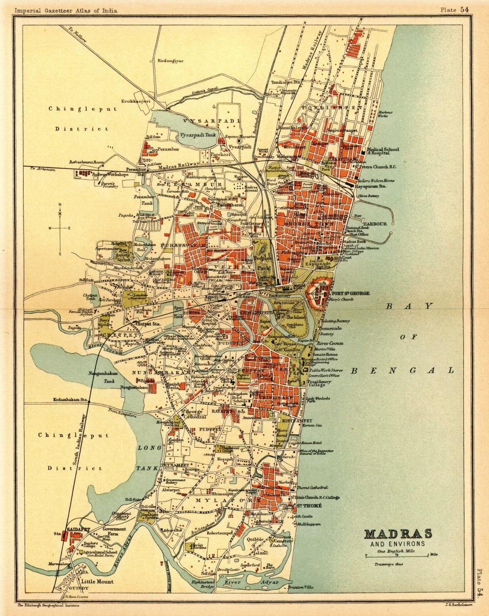
Map of the presidency town of Madras from Imperial Gazetteer of India, volume 26, Atlas, Oxford University Press. 1908. Scanned from personal copy, reduced, and uploaded by Fowler&fowler«Talk» 21:49, 7 March 2009 (UTC) |
|||||||||
| நாள் | ||||||||||
| மூலம் | Imperial Gazetteer of India, volume 26, Atlas, Oxford University Press. 1908. | |||||||||
| படைப்பாளி |
J. G. Bartholomew, Edinburgh |
|||||||||
| அனுமதி (இக்கோப்பை மீண்டும் பயன்படுத்துதல்) |
|
|||||||||
| Geotemporal data | ||||||||||
| Bounding box |
|
|||||||||
| Georeferencing | ||||||||||

.jpg)
கோப்பின் வரலாறு
குறித்த நேரத்தில் இருந்த படிமத்தைப் பார்க்க அந்நேரத்தின் மீது சொடுக்கவும்.
| நாள்/நேரம் | நகம் அளவு சிறுபடம் | அளவுகள் | பயனர் | கருத்து | |
|---|---|---|---|---|---|
| தற்போதைய | 23:55, 1 மார்ச்சு 2011 | | 954 × 1,200 (296 KB) | MALLUS | {{Information |Description=Map of the presidency town of Madras from ''Imperial Gazetteer of India'', volume 26, Atlas, Oxford University Press. 1908. Scanned from personal copy, reduced, and uploaded by [[User:Fowler&fowler|<font color="#B8860B">Fo |
கோப்பு பயன்பாடு
பின்வரும் பக்க இணைப்புகள் இப் படிமத்துக்கு இணைக்கபட்டுள்ளது(ளன):
கோப்பின் முழுமையான பயன்பாடு
கீழ்கண்ட மற்ற விக்கிகள் இந்த கோப்பை பயன்படுத்துகின்றன:
- ca.wikipedia.org-திட்டத்தில் இதன் பயன்பாடு
- de.wikipedia.org-திட்டத்தில் இதன் பயன்பாடு
- en.wikipedia.org-திட்டத்தில் இதன் பயன்பாடு
- es.wikipedia.org-திட்டத்தில் இதன் பயன்பாடு
- hi.wikipedia.org-திட்டத்தில் இதன் பயன்பாடு
- id.wikipedia.org-திட்டத்தில் இதன் பயன்பாடு
- it.wikipedia.org-திட்டத்தில் இதன் பயன்பாடு
- ne.wikipedia.org-திட்டத்தில் இதன் பயன்பாடு
- pt.wikipedia.org-திட்டத்தில் இதன் பயன்பாடு
- te.wikipedia.org-திட்டத்தில் இதன் பயன்பாடு
.jpg)