
படிமம்:Great Chicago Fire map.jpg
மூலக்கோப்பு (3,588 × 5,382 படவணுக்கள், கோப்பின் அளவு: 4.42 MB, MIME வகை: image/jpeg)
| இது விக்கிமீடியா பொதுக்கோப்பகத்தில் இருக்கும் ஒரு கோப்பாகும். இக்கோப்பைக் குறித்து அங்கே காணப்படும் படிம விளக்கப் பக்கத்தை இங்கே கீழே காணலாம்.
|
| விளக்கம் |
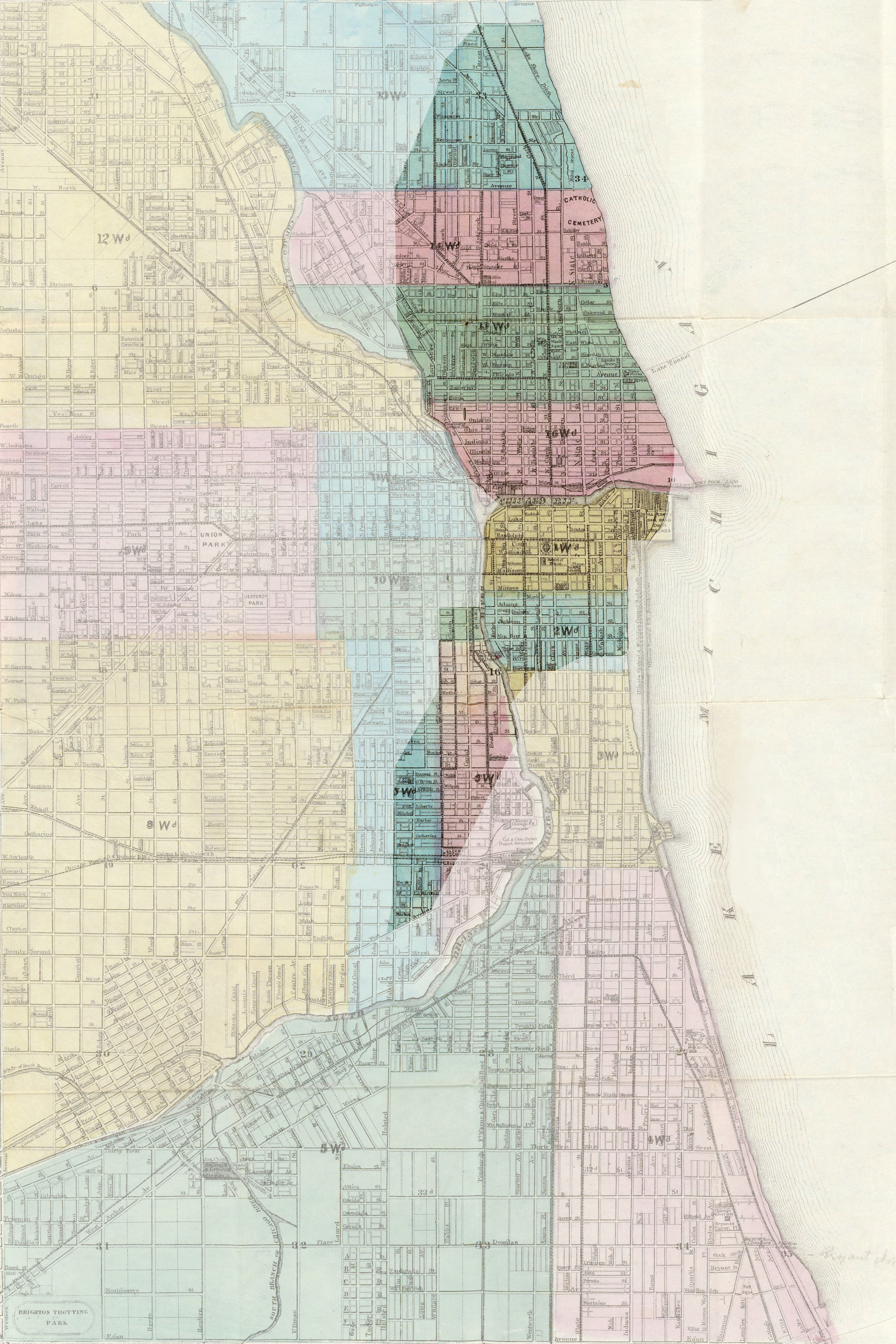
English: Map of Chicago, showing the burned area after the Great Chicago Fire in 1871. Français : Carte de Chicago, montrant la zone incendiée lors du Grand incendie de Chicago en 1871. Deutsch: Stadtplan von Chicago, die dunkle Fläche zeigt das Gebiet, das durch den Großen Brand von Chicago im Jahre 1871 zerstört wurde. |
| நாள் | (UTC) |
| மூலம் |
|
| ஆசிரியர் |
|
| Camera location | | View this and other nearby images on: OpenStreetMap |
|---|
| இது ஒரு திருத்தப்பட்ட படிமமாகும், அதாவது இதன் மூல வடிவத்திலிருந்து கணினி மூலம் இதில் மாற்றங்கள் செய்யப்பட்டுள்ளது. திருத்தங்கள்: Mise en valeur de la zone incendiée. மூலக்கோப்பை இங்கு காணலாம்: 1869 chicago.jpg. திருத்தங்களைச் செய்தவர் Sémhur.
|
|
This work is in the public domain in its country of origin and other countries and areas where the copyright term is the author's life plus 70 years or fewer.
| |
| This file has been identified as being free of known restrictions under copyright law, including all related and neighboring rights. | |
Original upload log
This image is a derivative work of the following images:
- File:1869_chicago.jpg licensed with PD-old
- 2005-08-12T08:01:34Z SPUI 4902x6376 (9280310 Bytes) {{PD}} 1869 map of Chicago from [http://www.davidrumsey.com/ davidrumsey.com]. [[Category:Maps of Chicago]]
Uploaded with derivativeFX
கோப்பின் வரலாறு
குறித்த நேரத்தில் இருந்த படிமத்தைப் பார்க்க அந்நேரத்தின் மீது சொடுக்கவும்.
| நாள்/நேரம் | நகம் அளவு சிறுபடம் | அளவுகள் | பயனர் | கருத்து | |
|---|---|---|---|---|---|
| தற்போதைய | 13:03, 17 பெப்பிரவரி 2009 | | 3,588 × 5,382 (4.42 MB) | Sémhur | {{Information |Description= {{en|Map of Chicago, showing the burned area during the Great Chicago Fire in 1871.}} {{fr|Carte de Chicago, montrant la zone incendiée lors du [[:fr:Grand incendie de Chicago|Grand incendie de Chica |
கோப்பு பயன்பாடு
பின்வரும் பக்க இணைப்புகள் இப் படிமத்துக்கு இணைக்கபட்டுள்ளது(ளன):
கோப்பின் முழுமையான பயன்பாடு
கீழ்கண்ட மற்ற விக்கிகள் இந்த கோப்பை பயன்படுத்துகின்றன:
- ca.wikipedia.org-திட்டத்தில் இதன் பயன்பாடு
- da.wikipedia.org-திட்டத்தில் இதன் பயன்பாடு
- de.wikipedia.org-திட்டத்தில் இதன் பயன்பாடு
- fr.wikipedia.org-திட்டத்தில் இதன் பயன்பாடு
- it.wikipedia.org-திட்டத்தில் இதன் பயன்பாடு
- ja.wikipedia.org-திட்டத்தில் இதன் பயன்பாடு
- lv.wikipedia.org-திட்டத்தில் இதன் பயன்பாடு
- no.wikipedia.org-திட்டத்தில் இதன் பயன்பாடு
- pl.wikipedia.org-திட்டத்தில் இதன் பயன்பாடு
- pt.wikipedia.org-திட்டத்தில் இதன் பயன்பாடு