
படிமம்:DarienCTUSCoastAndGeodeticSurvey1965Marker11042007.jpg

இந்த முன்னோட்டத்தின் அளவு: 687 × 600 படப்புள்ளிகள் . மற்ற பிரிதிறன்கள்: 275 × 240 படப்புள்ளிகள் | 550 × 480 படப்புள்ளிகள் | 880 × 768 படப்புள்ளிகள் | 1,173 × 1,024 படப்புள்ளிகள் | 1,290 × 1,126 படப்புள்ளிகள் .
மூலக்கோப்பு (1,290 × 1,126 படவணுக்கள், கோப்பின் அளவு: 606 KB, MIME வகை: image/jpeg)
| இது விக்கிமீடியா பொதுக்கோப்பகத்தில் இருக்கும் ஒரு கோப்பாகும். இக்கோப்பைக் குறித்து அங்கே காணப்படும் படிம விளக்கப் பக்கத்தை இங்கே கீழே காணலாம்.
|
சுருக்கம்
| விளக்கம் |
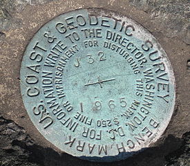
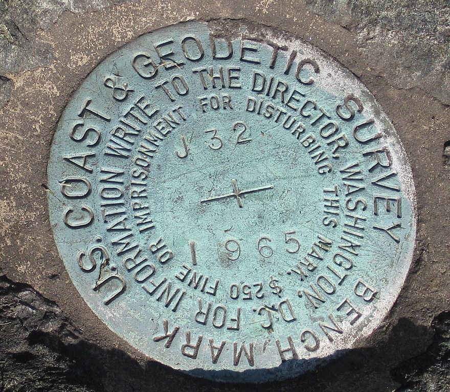
English: Marker, United States Coast and Geodetic Survey marker embedded in a large rock in front of the Noroton Volunteer Fire Department, Darien, Connecticut. |
| நாள் | 5 நவம்பர் 2007 (original upload date) |
| மூலம் | Transferred from en.wikipedia to Commons by Oxyman using CommonsHelper. |
| ஆசிரியர் | The original uploader was Noroton at ஆங்கிலம் விக்கிப்பீடியா. |
| Camera location | | View this and other nearby images on: OpenStreetMap |
|---|
அனுமதி
| This work has been released into the public domain by its author, Noroton at ஆங்கிலம் விக்கிப்பீடியா. This applies worldwide. சில நாடுகளில் இது சாத்தியமில்லாது போகலாம். அவ்வாறாயின் : Noroton grants anyone the right to use this work for any purpose, without any conditions, unless such conditions are required by law. |
Original upload log
The original description page was here. All following user names refer to en.wikipedia.
- 2007-11-05 02:12 Noroton 1290×1126× (620467 bytes) Marker, [[U.S. National Geodetic Survey]] marker embedded in a large rock in front of the Noroton Fire Department, [[Darien, Connecticut]]
கோப்பின் வரலாறு
குறித்த நேரத்தில் இருந்த படிமத்தைப் பார்க்க அந்நேரத்தின் மீது சொடுக்கவும்.
| நாள்/நேரம் | நகம் அளவு சிறுபடம் | அளவுகள் | பயனர் | கருத்து | |
|---|---|---|---|---|---|
| தற்போதைய | 21:59, 13 சூன் 2009 | | 1,290 × 1,126 (606 KB) | File Upload Bot (Magnus Manske) | {{BotMoveToCommons|en.wikipedia|year={{subst:CURRENTYEAR}}|month={{subst:CURRENTMONTHNAME}}|day={{subst:CURRENTDAY}}}} {{Information |Description={{en|Marker, en:U.S. National Geodetic Survey marker embedded in a large rock in front of the Noroton |
கோப்பு பயன்பாடு
பின்வரும் பக்க இணைப்புகள் இப் படிமத்துக்கு இணைக்கபட்டுள்ளது(ளன):
கோப்பின் முழுமையான பயன்பாடு
கீழ்கண்ட மற்ற விக்கிகள் இந்த கோப்பை பயன்படுத்துகின்றன:
- en.wikipedia.org-திட்டத்தில் இதன் பயன்பாடு
- fa.wikipedia.org-திட்டத்தில் இதன் பயன்பாடு
- fr.wikipedia.org-திட்டத்தில் இதன் பயன்பாடு
- it.wikipedia.org-திட்டத்தில் இதன் பயன்பாடு
- my.wikipedia.org-திட்டத்தில் இதன் பயன்பாடு
- nn.wikipedia.org-திட்டத்தில் இதன் பயன்பாடு
- pt.wikipedia.org-திட்டத்தில் இதன் பயன்பாடு
- simple.wikipedia.org-திட்டத்தில் இதன் பயன்பாடு
- tl.wikipedia.org-திட்டத்தில் இதன் பயன்பாடு
- uk.wikipedia.org-திட்டத்தில் இதன் பயன்பாடு
- www.wikidata.org-திட்டத்தில் இதன் பயன்பாடு