
படிமம்:Afghanistan insurgency 1985.png

இந்த முன்னோட்டத்தின் அளவு: 764 × 600 படப்புள்ளிகள் . மற்ற பிரிதிறன்கள்: 306 × 240 படப்புள்ளிகள் | 612 × 480 படப்புள்ளிகள் | 979 × 768 படப்புள்ளிகள் | 1,280 × 1,005 படப்புள்ளிகள் | 2,560 × 2,009 படப்புள்ளிகள் | 3,426 × 2,689 படப்புள்ளிகள் .
மூலக்கோப்பு (3,426 × 2,689 படவணுக்கள், கோப்பின் அளவு: 6.11 MB, MIME வகை: image/png)
| இது விக்கிமீடியா பொதுக்கோப்பகத்தில் இருக்கும் ஒரு கோப்பாகும். இக்கோப்பைக் குறித்து அங்கே காணப்படும் படிம விளக்கப் பக்கத்தை இங்கே கீழே காணலாம்.
|

|
This military map image could be re-created using vector graphics as an SVG file. This has several advantages; see Commons:Media for cleanup for more information. If an SVG form of this image is available, please upload it and afterwards replace this template with
{{vector version available|new image name}}.
It is recommended to name the SVG file “Afghanistan insurgency 1985.svg”—then the template Vector version available (or Vva) does not need the new image name parameter. |
| விளக்கம் |
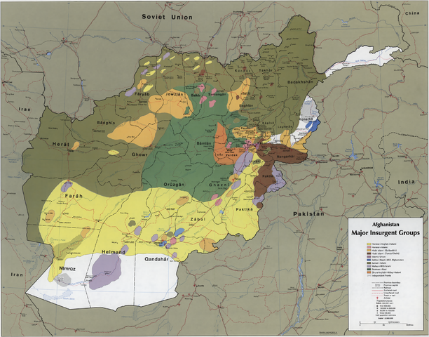
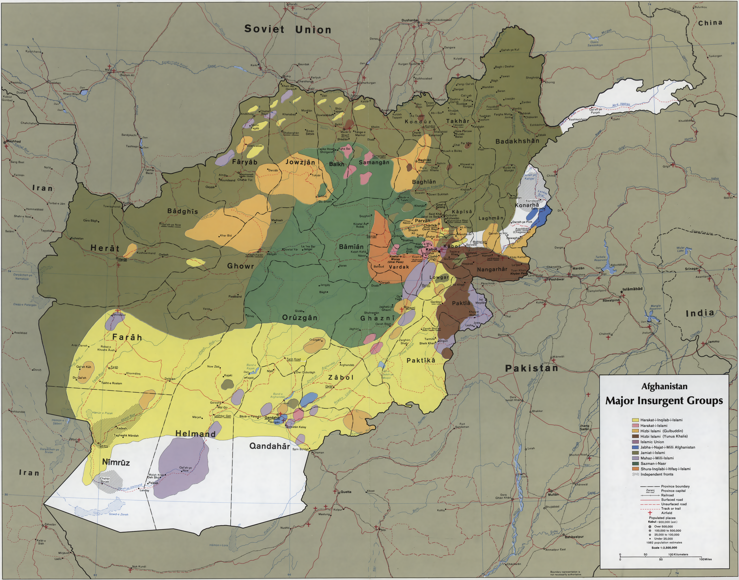
English: CIA map showing the areas where the main Mujahideen factions operated in 1985, during the Soviet war in Afghanistan. Scale 1:2,500,000 (E 60°–E 75°/N 29°–N 38°). |
|||
| நாள் | ||||
| மூலம் |
|
|||
| ஆசிரியர் | Central Intelligence Agency | |||
| அனுமதி (இக்கோப்பை மீண்டும் பயன்படுத்துதல்) |
|
|||
| ஒத்தக்கோப்பு | See file history for image in the original resolution (6,852×5,377). |


கோப்பின் வரலாறு
குறித்த நேரத்தில் இருந்த படிமத்தைப் பார்க்க அந்நேரத்தின் மீது சொடுக்கவும்.
| நாள்/நேரம் | நகம் அளவு சிறுபடம் | அளவுகள் | பயனர் | கருத்து | |
|---|---|---|---|---|---|
| தற்போதைய | 08:22, 23 ஆகத்து 2011 | | 3,426 × 2,689 (6.11 MB) | Mikhail Ryazanov | Rescaled to 50% for thumbnailing (12.5 Mpx limit). |
| 08:17, 23 ஆகத்து 2011 |  | 6,852 × 5,377 (13.16 MB) | Mikhail Ryazanov | {{Information |Description ={{en|1=CIA map showing the areas where the main Mujahideen factions operated in 1985, during the Soviet war in Afghanistan. Scale 1:2,500,000 (E 600--E 750/N 380--N 290).}} |Source ={{LOC-map|id=g7631r.ct001104}} |Au |
கோப்பு பயன்பாடு
பின்வரும் பக்க இணைப்புகள் இப் படிமத்துக்கு இணைக்கபட்டுள்ளது(ளன):
கோப்பின் முழுமையான பயன்பாடு
கீழ்கண்ட மற்ற விக்கிகள் இந்த கோப்பை பயன்படுத்துகின்றன:
- azb.wikipedia.org-திட்டத்தில் இதன் பயன்பாடு
- ba.wikipedia.org-திட்டத்தில் இதன் பயன்பாடு
- br.wikipedia.org-திட்டத்தில் இதன் பயன்பாடு
- de.wikipedia.org-திட்டத்தில் இதன் பயன்பாடு
- en.wikipedia.org-திட்டத்தில் இதன் பயன்பாடு
- fa.wikipedia.org-திட்டத்தில் இதன் பயன்பாடு
- it.wikipedia.org-திட்டத்தில் இதன் பயன்பாடு
- pt.wikipedia.org-திட்டத்தில் இதன் பயன்பாடு
- ro.wikipedia.org-திட்டத்தில் இதன் பயன்பாடு
- ru.wikipedia.org-திட்டத்தில் இதன் பயன்பாடு
- sh.wikipedia.org-திட்டத்தில் இதன் பயன்பாடு
- uk.wikipedia.org-திட்டத்தில் இதன் பயன்பாடு