படிமம்:1876 Wallace Guide Map of NY Wilderness.JPG

மற்ற மொழிகளில் ஆதரிக்கப்படாத பக்க உள்ளடக்கம்.
கட்டற்ற கலைக்களஞ்சியமான விக்கிப்பீடியாவில் இருந்து.

மூலக்கோப்பு(7,571 × 8,754 படவணுக்கள், கோப்பின் அளவு: 20.46 MB, MIME வகை: image/jpeg)

இது விக்கிமீடியா பொதுக்கோப்பகத்தில் இருக்கும் ஒரு கோப்பாகும். இக்கோப்பைக் குறித்து அங்கே காணப்படும் படிம விளக்கப் பக்கத்தை இங்கே கீழே காணலாம்.
பொதுக்கோப்பகம் ஒரு கட்டற்ற கோப்புகளின் சேமிப்பகமாகும். நீங்களும் உதவலாம்.
Warning The original file is very high-resolution. It might not load properly or could cause your browser to freeze when opened at full size.

சுருக்கம்

விளக்கம்
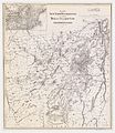
English: Map from Descriptive guide to the Adirondacks, and handbook of travel to Saratoga Springs, Schroon Lake, lakes Luzerne, George and Champlain, the Ausable Chasm, the Thousand Islands, Massena Springs and Trenton Falls by E. R. Wallace (1875). Scanned and archived at http://www.oldbookart.com where it was marked as Public Domain. Very interesting map as it shows many of the older names for peaks and places.
நாள்
மூலம் http://www.gallery.oldbookart.com/main.php?g2_itemId=30847
ஆசிரியர் W. W. Ely

அனுமதி

This image is in the public domain because it is a mere mechanical scan or photocopy of a public domain original, or – from the available evidence – is so similar to such a scan or photocopy that no copyright protection can be expected to arise. The original itself is in the public domain for the following reason:
Public domain

This work is in the public domain in its country of origin and other countries and areas where the copyright term is the author's life plus 70 years or fewer.


This work is in the public domain in the United States because it was published (or registered with the U.S. Copyright Office) before January 1, 1929.


This tag is designed for use where there may be a need to assert that any enhancements (eg brightness, contrast, colour-matching, sharpening) are in themselves insufficiently creative to generate a new copyright. It can be used where it is unknown whether any enhancements have been made, as well as when the enhancements are clear but insufficient. For known raw unenhanced scans you can use an appropriate {{PD-old}} tag instead. For usage, see Commons:When to use the PD-scan tag.


Note: This tag applies to scans and photocopies only. For photographs of public domain originals taken from afar, {{PD-Art}} may be applicable. See Commons:When to use the PD-Art tag.

Captions

Add a one-line explanation of what this file represents

Items portrayed in this file

depicts ஆங்கிலம்

checksum ஆங்கிலம்

5c1abd51e9c3db5553df49a765b5cd8ca6fbe3a9

data size ஆங்கிலம்

2,14,56,826 பைட்டு

8,754 படவணு

7,571 படவணு

கோப்பின் வரலாறு

குறித்த நேரத்தில் இருந்த படிமத்தைப் பார்க்க அந்நேரத்தின் மீது சொடுக்கவும்.

நாள்/நேரம்நகம் அளவு சிறுபடம்அளவுகள்பயனர்கருத்து
தற்போதைய18:11, 29 பெப்பிரவரி 201218:11, 29 பெப்பிரவரி 2012 இலிருந்த பதிப்புக்கான சிறு தோற்றம்7,571 × 8,754 (20.46 MB)John Sweeney

பின்வரும் பக்க இணைப்புகள் இப் படிமத்துக்கு இணைக்கபட்டுள்ளது(ளன):

கோப்பின் முழுமையான பயன்பாடு

கீழ்கண்ட மற்ற விக்கிகள் இந்த கோப்பை பயன்படுத்துகின்றன:

  • ca.wikipedia.org-திட்டத்தில் இதன் பயன்பாடு
  • en.wikipedia.org-திட்டத்தில் இதன் பயன்பாடு
  • es.wikipedia.org-திட்டத்தில் இதன் பயன்பாடு
  • hr.wikipedia.org-திட்டத்தில் இதன் பயன்பாடு
  • sr.wikipedia.org-திட்டத்தில் இதன் பயன்பாடு
  • vi.wikipedia.org-திட்டத்தில் இதன் பயன்பாடு

மேனிலைத் தரவு

"https://ta.wikipedia.org/wiki/படிமம்:1876_Wallace_Guide_Map_of_NY_Wilderness.JPG" இலிருந்து மீள்விக்கப்பட்டது