
படிமம்:1561 map of West Africa by Girolamo Ruscelli.JPG

இந்த முன்னோட்டத்தின் அளவு: 781 × 599 படப்புள்ளிகள் . மற்ற பிரிதிறன்கள்: 313 × 240 படப்புள்ளிகள் | 626 × 480 படப்புள்ளிகள் | 1,001 × 768 படப்புள்ளிகள் | 1,200 × 921 படப்புள்ளிகள் .
மூலக்கோப்பு (1,200 × 921 படவணுக்கள், கோப்பின் அளவு: 1.64 MB, MIME வகை: image/jpeg)
| இது விக்கிமீடியா பொதுக்கோப்பகத்தில் இருக்கும் ஒரு கோப்பாகும். இக்கோப்பைக் குறித்து அங்கே காணப்படும் படிம விளக்கப் பக்கத்தை இங்கே கீழே காணலாம்.
|
சுருக்கம்
| விளக்கம் |
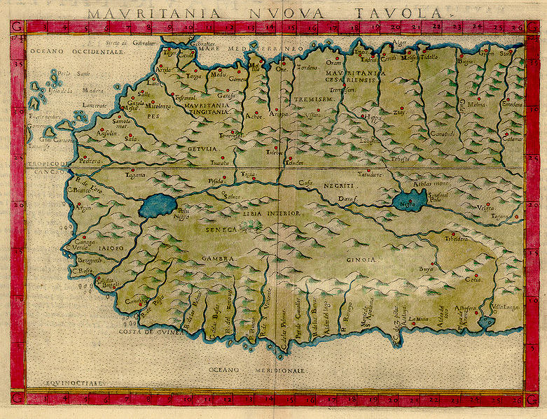
MAVRITANIA NVOVA TAVOLA, from Italian translation of Ptolemy's Atlas “La Geograpfia Di Claudio Tolomeo Alessandrino, Nouvamente Tradatta Di Greco in Italiano”. Published in 1575 in Latin and Italian. 17.5 x 23.9 cm. On sheet 22 X 32.1 cm. |
||||||||||||||||||||||||||
| நாள் | (published 1575) | ||||||||||||||||||||||||||
| மூலம் | The University of Florida Map & Image Library | ||||||||||||||||||||||||||
| ஆசிரியர் |
|
||||||||||||||||||||||||||
| ஒத்தக்கோப்பு |
|
||||||||||||||||||||||||||

.png)
அனுமதி
|
This is a faithful photographic reproduction of a two-dimensional, public domain work of art. The work of art itself is in the public domain for the following reason:
The official position taken by the Wikimedia Foundation is that "faithful reproductions of two-dimensional public domain works of art are public domain".
This photographic reproduction is therefore also considered to be in the public domain in the United States. In other jurisdictions, re-use of this content may be restricted; see Reuse of PD-Art photographs for details. | ||||
கோப்பின் வரலாறு
குறித்த நேரத்தில் இருந்த படிமத்தைப் பார்க்க அந்நேரத்தின் மீது சொடுக்கவும்.
| நாள்/நேரம் | நகம் அளவு சிறுபடம் | அளவுகள் | பயனர் | கருத்து | |
|---|---|---|---|---|---|
| தற்போதைய | 17:23, 13 சூலை 2007 | | 1,200 × 921 (1.64 MB) | Hispalois | {{Information |Description=MAVRITANIA NVOVA TAVOLA, from Italian translation of Ptolemy's Atlas “La Geograpfia Di Claudio Tolomeo Alessandrino, Nouvamente Tradatta Di Greco in Italiano”. Published in 1575 in Latin and Italian. 17.5 x 23.9 cm. On sheet |
கோப்பு பயன்பாடு
பின்வரும் பக்க இணைப்புகள் இப் படிமத்துக்கு இணைக்கபட்டுள்ளது(ளன):
கோப்பின் முழுமையான பயன்பாடு
கீழ்கண்ட மற்ற விக்கிகள் இந்த கோப்பை பயன்படுத்துகின்றன:
- bg.wikipedia.org-திட்டத்தில் இதன் பயன்பாடு
- de.wikipedia.org-திட்டத்தில் இதன் பயன்பாடு
- en.wikipedia.org-திட்டத்தில் இதன் பயன்பாடு
- eo.wikipedia.org-திட்டத்தில் இதன் பயன்பாடு
- es.wikipedia.org-திட்டத்தில் இதன் பயன்பாடு
- fr.wikipedia.org-திட்டத்தில் இதன் பயன்பாடு
- it.wikipedia.org-திட்டத்தில் இதன் பயன்பாடு
- no.wikipedia.org-திட்டத்தில் இதன் பயன்பாடு
- ru.wikipedia.org-திட்டத்தில் இதன் பயன்பாடு
- sl.wikipedia.org-திட்டத்தில் இதன் பயன்பாடு
- sr.wikipedia.org-திட்டத்தில் இதன் பயன்பாடு
- uk.wikipedia.org-திட்டத்தில் இதன் பயன்பாடு