
படிமம்:Sierra Leone location map.svg

Size of this PNG preview of this SVG file: 600 × 600 படப்புள்ளிகள். மற்ற பிரிதிறன்கள்: 240 × 240 படப்புள்ளிகள் | 480 × 480 படப்புள்ளிகள் | 768 × 768 படப்புள்ளிகள் | 1,024 × 1,024 படப்புள்ளிகள் | 2,048 × 2,048 படப்புள்ளிகள் | 1,607 × 1,607 படப்புள்ளிகள் .
மூலக்கோப்பு (SVG கோப்பு, பெயரளவில் 1,607 × 1,607 பிக்சல்கள், கோப்பு அளவு: 244 KB)
| இது விக்கிமீடியா பொதுக்கோப்பகத்தில் இருக்கும் ஒரு கோப்பாகும். இக்கோப்பைக் குறித்து அங்கே காணப்படும் படிம விளக்கப் பக்கத்தை இங்கே கீழே காணலாம்.
|
| விளக்கம் |
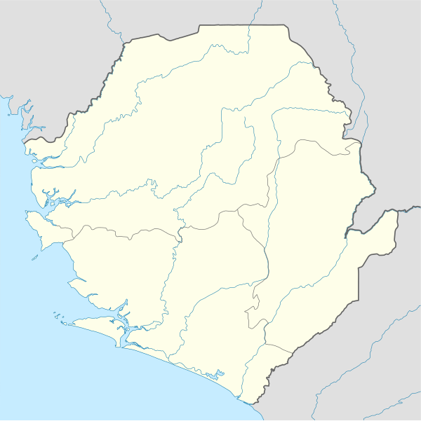
Deutsch: Positionskarte von Sierra Leone
Quadratische Plattkarte. Geographische Begrenzung der Karte:
English: Location map of Sierra Leone
Equirectangular projection. Geographic limits of the map:
|
|||
| நாள் | 10 திசம்பர் 2008 (upload date) | |||
| மூலம் |
own work, using
|
|||
| ஆசிரியர் | NordNordWest | |||
| அனுமதி (இக்கோப்பை மீண்டும் பயன்படுத்துதல்) |
|
|||
| ஒத்தக்கோப்பு |
Derivative works of this file: |


|
This map has been made or improved in the German Kartenwerkstatt (Map Lab). You can propose maps to improve as well.
|
கோப்பின் வரலாறு
குறித்த நேரத்தில் இருந்த படிமத்தைப் பார்க்க அந்நேரத்தின் மீது சொடுக்கவும்.
| நாள்/நேரம் | நகம் அளவு சிறுபடம் | அளவுகள் | பயனர் | கருத்து | |
|---|---|---|---|---|---|
| தற்போதைய | 19:39, 10 திசம்பர் 2008 | | 1,607 × 1,607 (244 KB) | NordNordWest | {{Information |Description= {{de|Positionskarte von Sierra Leone}} Quadratische Plattkarte. Geographische Begrenzung der Karte: * N: 10.2° N * S: 6.8° N * W: 13.5° W * O: 10.1° W {{en|Location map of [[:en:Sierra Leone|Sierra Leon |
கோப்பு பயன்பாடு
இப் படிமத்துக்கு இணைக்கப்பட்டுள்ள பக்கங்கள் எதுவும் இல்லை.
கோப்பின் முழுமையான பயன்பாடு
கீழ்கண்ட மற்ற விக்கிகள் இந்த கோப்பை பயன்படுத்துகின்றன:
- af.wikipedia.org-திட்டத்தில் இதன் பயன்பாடு
- am.wikipedia.org-திட்டத்தில் இதன் பயன்பாடு
- an.wikipedia.org-திட்டத்தில் இதன் பயன்பாடு
- ar.wikipedia.org-திட்டத்தில் இதன் பயன்பாடு
- az.wikipedia.org-திட்டத்தில் இதன் பயன்பாடு
- be-tarask.wikipedia.org-திட்டத்தில் இதன் பயன்பாடு
- be.wikipedia.org-திட்டத்தில் இதன் பயன்பாடு
- bg.wikipedia.org-திட்டத்தில் இதன் பயன்பாடு
- bn.wikipedia.org-திட்டத்தில் இதன் பயன்பாடு
- bs.wikipedia.org-திட்டத்தில் இதன் பயன்பாடு
- ceb.wikipedia.org-திட்டத்தில் இதன் பயன்பாடு
சிறப்பு பக்கம்-மொத்த பயன்பாடு - இதன் மூலம் இந்த கோப்பின் மொத்த பயன்பாட்டை அறிய முடியும்