
படிமம்:LoireAtlantique Arrondissement Color.svg

Size of this PNG preview of this SVG file: 710 × 600 படப்புள்ளிகள். மற்ற பிரிதிறன்கள்: 284 × 240 படப்புள்ளிகள் | 568 × 480 படப்புள்ளிகள் | 909 × 768 படப்புள்ளிகள் | 1,212 × 1,024 படப்புள்ளிகள் | 2,425 × 2,048 படப்புள்ளிகள் | 998 × 843 படப்புள்ளிகள் .
மூலக்கோப்பு (SVG கோப்பு, பெயரளவில் 998 × 843 பிக்சல்கள், கோப்பு அளவு: 49 KB)
| இது விக்கிமீடியா பொதுக்கோப்பகத்தில் இருக்கும் ஒரு கோப்பாகும். இக்கோப்பைக் குறித்து அங்கே காணப்படும் படிம விளக்கப் பக்கத்தை இங்கே கீழே காணலாம்.
|
சுருக்கம்
| விளக்கம் |
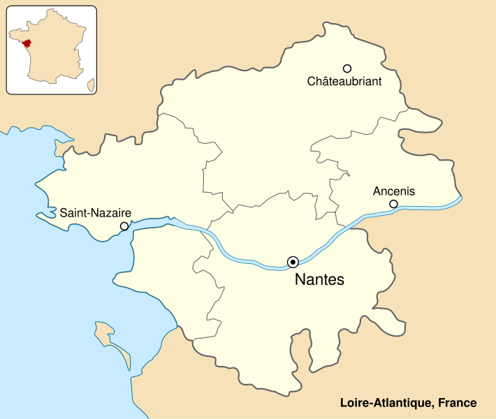
English: Colored map of department of Loire-Atlantique, France. Français : Carte en couleur du département de Loire-Atlantique, France. |
||
| நாள் | |||
| மூலம் | சொந்த முயற்சி | ||
| ஆசிரியர் | Sémhur (talk) | ||
| ஒத்தக்கோப்பு | Image:LoireAtlantique_Arrondissement_Grey.svg | ||
| பண்புக்கூறுகள் (required by the license) | © Sémhur / Wikimedia Commons / | ||
| SVG | W3C-validity not checked.
|
||
| Atelier graphique |

| Camera location | | View this and other nearby images on: OpenStreetMap |
|---|
அனுமதி
இந்த ஆக்கத்தின் காப்புரிமையாளரான நான் இதனைப் பின்வரும் உரிமத்தின் கீழ் வெளியிடுகின்றேன்:
| Copyleft: This work of art is free; you can redistribute it and/or modify it according to terms of the Free Art License. You will find a specimen of this license on the Copyleft Attitude site as well as on other sites. |
This file is licensed under the Creative Commons Attribution-Share Alike 4.0 International, 3.0 Unported, 2.5 Generic, 2.0 Generic and 1.0 Generic license.
- நீங்கள் சுதந்திரமாக:
- பகிர்ந்து கொள்ள – வேலையை நகலெடுக்க, விநியோகிக்க மற்றும் அனுப்ப
- மீண்டும் கலக்க – வேலைக்கு பழகிக்கொள்ள.
- கீழ்க்காணும் விதிகளுக்கு ஏற்ப,
- பண்புக்கூறுகள் – நீங்கள் பொருத்தமான உரிமையை வழங்க வேண்டும், உரிமத்திற்கான இணைப்பை வழங்க வேண்டும் மற்றும் மாற்றங்கள் செய்யப்பட்டிருந்தால் குறிப்பிட வேண்டும். நீங்கள் ஏற்புடைய எந்த முறையிலும் அவ்வாறு செய்யலாம், ஆனால் எந்த வகையிலும் உரிமதாரர் உங்களை அல்லது உங்கள் பயன்பாட்டிற்கு ஒப்புதல் அளிக்கும் படி பரிந்துரைக்க கூடாது.
- அதே மாதிரி பகிர் – நீங்கள் ரீமிக்ஸ் செய்தாலோ, உருமாற்றம் செய்தாலோ அல்லது பொருளை உருவாக்கினாலோ, உங்கள் பங்களிப்புகளை அல்லது இணக்கமான உரிமம் கீழ் அசலாக விநியோகிக்க வேண்டும்.
நீர் உமக்கு விருப்பமான உரிமத்தை தேர்ந்தெடுக்கலாம்.
கோப்பின் வரலாறு
குறித்த நேரத்தில் இருந்த படிமத்தைப் பார்க்க அந்நேரத்தின் மீது சொடுக்கவும்.
| நாள்/நேரம் | நகம் அளவு சிறுபடம் | அளவுகள் | பயனர் | கருத்து | |
|---|---|---|---|---|---|
| தற்போதைய | 12:20, 12 ஏப்பிரல் 2013 | | 998 × 843 (49 KB) | Sémhur | Update colors |
| 18:06, 6 சூலை 2007 |  | 1,000 × 845 (49 KB) | Sémhur | {{Information |Description= {{fr|Carte en couleur du département de Loire-Atlantique, France.}} {{en|Colored map of department of Loire-Atlantique, France.}} |Source=Œuvre personnelle - Own work. |Date=2 |
கோப்பு பயன்பாடு
பின்வரும் பக்க இணைப்புகள் இப் படிமத்துக்கு இணைக்கபட்டுள்ளது(ளன):
கோப்பின் முழுமையான பயன்பாடு
கீழ்கண்ட மற்ற விக்கிகள் இந்த கோப்பை பயன்படுத்துகின்றன:
- ar.wikipedia.org-திட்டத்தில் இதன் பயன்பாடு
- ca.wikipedia.org-திட்டத்தில் இதன் பயன்பாடு
- cs.wikipedia.org-திட்டத்தில் இதன் பயன்பாடு
- de.wikipedia.org-திட்டத்தில் இதன் பயன்பாடு
- en.wikipedia.org-திட்டத்தில் இதன் பயன்பாடு
- es.wikipedia.org-திட்டத்தில் இதன் பயன்பாடு
- fr.wikipedia.org-திட்டத்தில் இதன் பயன்பாடு
- Utilisateur:Iveragh
- Utilisateur:Gwalarn
- Projet:Bretagne
- Utilisateur:Ganymede44
- Utilisateur:AIRAZUR
- Utilisateur:Damien Perrotin~frwiki
- Utilisateur:Wikbls
- Utilisateur:Louis Kehlweiler
- Utilisateur:Alex zlb35
- Utilisateur:Kertraon
- Utilisateur:Esperanza222
- Utilisateur:Betp
- Utilisateur:Gilouu
- Utilisateur:Breizh5
- Utilisateur:Ole Einar
- Projet:Bretagne/Modèles
- Modèle:Utilisateur rattachement Loire-Atlantique
- Utilisateur:S. DÉNIEL
- Utilisateur:Yeurc h
- Utilisateur:SPQRobin
- Utilisateur:Hellotheworld
- Utilisateur:Kilkenny03
- Utilisateur:Thomas de Vernet
- Utilisateur:Hercule
- Utilisateur:SpiderStratagem
- Utilisateur:Etienne.deniau
- Utilisateur:Esperanza222/Boîtes utilisateur
- Utilisateur:Mathinus
- Utilisateur:Rundvald
- Utilisateur:Kergourlay
- Utilisateur:Naonediz44
- Utilisateur:Breizh85
- Utilisateur:AnticRab
- Utilisateur:Wuotanswrath
- Utilisateur:Fabienamnet
- Utilisateur:Misoco59
- Utilisateur:Pyrite
- Utilisateur:Bryan Schneider
- Utilisateur:Df
- Utilisateur:Palermo2000
- Utilisateur:Kendalph
- Utilisateur:Kafopa
- Utilisateur:Trizek/Bio en boîtes
சிறப்பு பக்கம்-மொத்த பயன்பாடு - இதன் மூலம் இந்த கோப்பின் மொத்த பயன்பாட்டை அறிய முடியும்